

Road cycling. Val d'Aran - Pyrenees: Tour Vielha with Superbagneres
A cycling route starting in Les, Catalonia, Spain.
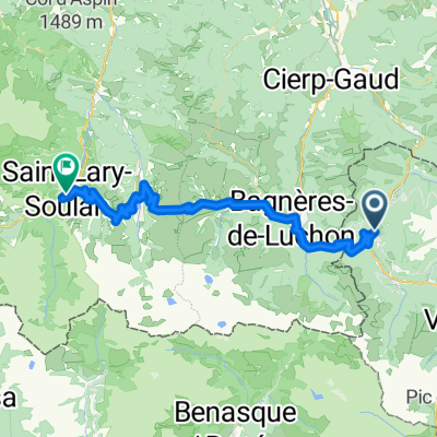
Overview
About this route
This route starts in Bossòst, but could just as easily serve for cyclists staying in Vielha, who could reach Bossòst along the N-230’s wide shoulders.
We start in Bossòst, leaving the town from the south, along the River Garona, and turning uphill, right at the roundabout, up the N-141. This is the beginning of the Portilhon, the col which marks the border between Spain and France. It starts with a series of hairpins affording great views back out over Bossòst, climbs past Aran Park, and after crossing the border at the top, sweeps quickly down into France.
At Saint-Mamet, if you’ve got good legs, follow the GPS track left, after you cross over the River Pique, to head towards the climb up to Superbagnères. This climb is a dead-end, meaning you will climb to the top and return to this point. So if you would rather leave it out, turn right after crossing the River Pique and continue through Bagneres de Luchon.
If you decide to climb to Superbagnères, it ramps up quite soon after leaving Saint-Mamet, including some ramps of 12% within the first two kilometres. The total climb is 18.5 kilometres, and for expert cyclists. The total elevation gain is 1170m, which brings you up to over 1800m if altitude, with an average gradient of 6.3%. You’ll eventually leave the tree line behind, and the landscape opens up to wide open high-altitude pastures, with views of many of the 3000m high snowy peaks in the region. Once you reach the ski station at the top, all that remains is to turn around, and enjoy the descent back down to Bagnères-de-Luchon!
The route now crosses Bagnères-de-Luchon from south to north, then follows the River Pique, along the D125, all the way to Gaud, where we bend right at the roundabout and join the D44, towards Marignac. The D44 is an easy enough road, climbing very gently after Marignac. We arrive at the valley of the River Garonne, and turn right onto the N125, which continues to climb softly, along the river valley, towards the Spanish border.
Points of Interest The climb up to Superbagnères is a pilgrimage ride for Tour de France fans, who have witnessed many a famous battle between the world’s top cyclists on its ramps. It is very wild, and there are nice views (and sounds) of the River Lys crashing downwards alongside the road, along the route.
- -:--
- Duration
- 90.2 km
- Distance
- 2,386 m
- Ascent
- 2,386 m
- Descent
- ---
- Avg. speed
- ---
- Max. altitude

Route quality
Waytypes & surfaces along the route
Waytypes
Road
33.4 km
(37 %)
Quiet road
1.8 km
(2 %)
Surfaces
Paved
46.9 km
(52 %)
Asphalt
46.9 km
(52 %)
Undefined
43.3 km
(48 %)
Continue with Bikemap
Use, edit, or download this cycling route
You would like to ride Road cycling. Val d'Aran - Pyrenees: Tour Vielha with Superbagneres or customize it for your own trip? Here is what you can do with this Bikemap route:
Free features
- Save this route as favorite or in collections
- Copy & plan your own version of this route
- Split it into stages to create a multi-day tour
- Sync your route with Garmin or Wahoo
Premium features
Free trial for 3 days, or one-time payment. More about Bikemap Premium.
- Navigate this route on iOS & Android
- Export a GPX / KML file of this route
- Create your custom printout (try it for free)
- Download this route for offline navigation
Discover more Premium features.
Get Bikemap PremiumFrom our community
Other popular routes starting in Les
 Bossost 2
- Distance
- 115 km
- Ascent
- 2,516 m
- Descent
- 2,512 m
- Location
- Les, Catalonia, Spain
 Road Cycling: Aran - Haute Garonne Loop
- Distance
- 136.4 km
- Ascent
- 4,122 m
- Descent
- 4,121 m
- Location
- Les, Catalonia, Spain
 Road cycling. Val d'Aran - Pyrenees: Tour Vielha with Superbagneres
- Distance
- 90.2 km
- Ascent
- 2,386 m
- Descent
- 2,386 m
- Location
- Les, Catalonia, Spain
 PIRINEOS MÍTICOS 2020
- Distance
- 386.7 km
- Ascent
- 14,434 m
- Descent
- 14,347 m
- Location
- Les, Catalonia, Spain
 Bossot-Portillon-Peyragudes-Val Louron-Saint Lary Soulan
- Distance
- 62.4 km
- Ascent
- 2,168 m
- Descent
- 2,057 m
- Location
- Les, Catalonia, Spain
 transpirenaica etapa - vielha - colliure
- Distance
- 336.1 km
- Ascent
- 4,760 m
- Descent
- 5,456 m
- Location
- Les, Catalonia, Spain
 waypoint puertos pirineos
- Distance
- 51.7 km
- Ascent
- 1,322 m
- Descent
- 981 m
- Location
- Les, Catalonia, Spain
 Gravel Bike /MTB. Val d'Aran - Pyrenees: Vall de Toran: Les | Pista Portet | Honeria | Canejan | Les
- Distance
- 36.8 km
- Ascent
- 1,211 m
- Descent
- 1,214 m
- Location
- Les, Catalonia, Spain
Open it in the app