

1990 - Přejezd slovenských hor
A cycling route starting in Strba, Prešov Region, Slovakia.
Overview
About this route
14th to 16th April 1990
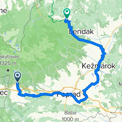
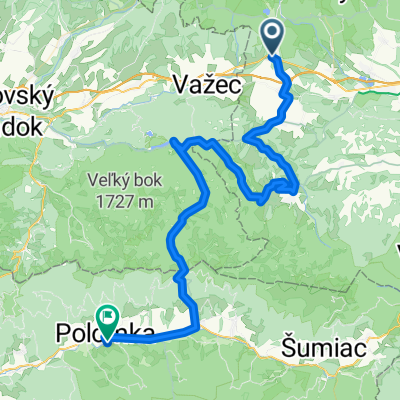
Štrba - Košice
- -:--
- Duration
- 275.5 km
- Distance
- 4,662 m
- Ascent
- 5,351 m
- Descent
- ---
- Avg. speed
- ---
- Max. altitude

Route quality
Waytypes & surfaces along the route
Waytypes
Road
96.4 km
(35 %)
Quiet road
41.3 km
(15 %)
Surfaces
Paved
165.3 km
(60 %)
Unpaved
8.3 km
(3 %)
Asphalt
157 km
(57 %)
Paved (undefined)
8.3 km
(3 %)
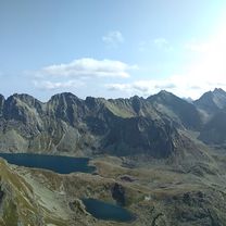
Route highlights
Points of interest along the route
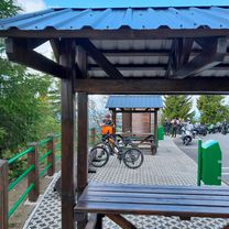
Accommodation after 84.4 km
Accommodation after 181.9 km
Continue with Bikemap
Use, edit, or download this cycling route
You would like to ride 1990 - Přejezd slovenských hor or customize it for your own trip? Here is what you can do with this Bikemap route:
Free features
- Save this route as favorite or in collections
- Copy & plan your own version of this route
- Split it into stages to create a multi-day tour
- Sync your route with Garmin or Wahoo
Premium features
Free trial for 3 days, or one-time payment. More about Bikemap Premium.
- Navigate this route on iOS & Android
- Export a GPX / KML file of this route
- Create your custom printout (try it for free)
- Download this route for offline navigation
Discover more Premium features.
Get Bikemap PremiumFrom our community
Other popular routes starting in Strba
 Přejezd slovenských hor 2022
- Distance
- 898.8 km
- Ascent
- 8,696 m
- Descent
- 9,429 m
- Location
- Strba, Prešov Region, Slovakia
 Hřebenovka Nízké Tatry & Velká Fatra - Den 7. -Andrejcová - Telgárt (pěšky)
- Distance
- 15.8 km
- Ascent
- 756 m
- Descent
- 1,271 m
- Location
- Strba, Prešov Region, Slovakia
 28.08.18 Grań Baszt
- Distance
- 15.7 km
- Ascent
- 1,550 m
- Descent
- 1,555 m
- Location
- Strba, Prešov Region, Slovakia
 Wokół Tatr Day 3
- Distance
- 69.6 km
- Ascent
- 756 m
- Descent
- 792 m
- Location
- Strba, Prešov Region, Slovakia
 2020 - Přejezd slovenských hor
- Distance
- 335.8 km
- Ascent
- 5,751 m
- Descent
- 6,533 m
- Location
- Strba, Prešov Region, Slovakia
 2021 - Přejezd slovenských hor
- Distance
- 370.5 km
- Ascent
- 6,691 m
- Descent
- 7,472 m
- Location
- Strba, Prešov Region, Slovakia
 Štrba - Heľpa - Polomka
- Distance
- 67.3 km
- Ascent
- 1,024 m
- Descent
- 1,344 m
- Location
- Strba, Prešov Region, Slovakia
 Štrba to Spišská Nová Ves
- Distance
- 62.8 km
- Ascent
- 721 m
- Descent
- 1,164 m
- Location
- Strba, Prešov Region, Slovakia
Open it in the app