

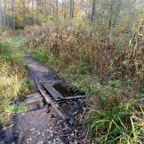
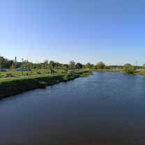
Прогулка в Пуща Водицу
A cycling route starting in Kotsiubynske, Kyiv City, Ukraine.
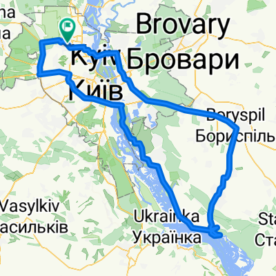
Overview
About this route
- 3 h 33 min
- Duration
- 28.1 km
- Distance
- 155 m
- Ascent
- 154 m
- Descent
- 7.9 km/h
- Avg. speed
- ---
- Max. altitude

Continue with Bikemap
Use, edit, or download this cycling route
You would like to ride Прогулка в Пуща Водицу or customize it for your own trip? Here is what you can do with this Bikemap route:
Free features
- Save this route as favorite or in collections
- Copy & plan your own version of this route
- Sync your route with Garmin or Wahoo
Premium features
Free trial for 3 days, or one-time payment. More about Bikemap Premium.
- Navigate this route on iOS & Android
- Export a GPX / KML file of this route
- Create your custom printout (try it for free)
- Download this route for offline navigation
Discover more Premium features.
Get Bikemap PremiumFrom our community
Other popular routes starting in Kotsiubynske
 Киев - Коцюбинское - Белогородка - Киев
- Distance
- 38.7 km
- Ascent
- 136 m
- Descent
- 138 m
- Location
- Kotsiubynske, Kyiv City, Ukraine
 ПущаВодица
- Distance
- 42.4 km
- Ascent
- 857 m
- Descent
- 833 m
- Location
- Kotsiubynske, Kyiv City, Ukraine
 easter holiday on quarantine
- Distance
- 174.5 km
- Ascent
- 345 m
- Descent
- 354 m
- Location
- Kotsiubynske, Kyiv City, Ukraine
 Пещера Геонавт
- Distance
- 82.5 km
- Ascent
- 229 m
- Descent
- 229 m
- Location
- Kotsiubynske, Kyiv City, Ukraine
 От Школа до вулиця Залізнична 9, Коцюбинське
- Distance
- 20.3 km
- Ascent
- 320 m
- Descent
- 265 m
- Location
- Kotsiubynske, Kyiv City, Ukraine
 Кийловская Аскания
- Distance
- 152.5 km
- Ascent
- 183 m
- Descent
- 183 m
- Location
- Kotsiubynske, Kyiv City, Ukraine
 КиУР - ОП "Змеиные Валы"
- Distance
- 95.2 km
- Ascent
- 354 m
- Descent
- 354 m
- Location
- Kotsiubynske, Kyiv City, Ukraine
 Озера и источники Пуща-Водицы
- Distance
- 20 km
- Ascent
- 98 m
- Descent
- 98 m
- Location
- Kotsiubynske, Kyiv City, Ukraine
Open it in the app