VUELTA al CERRO SOMBRA de TORO- TORNQUIST
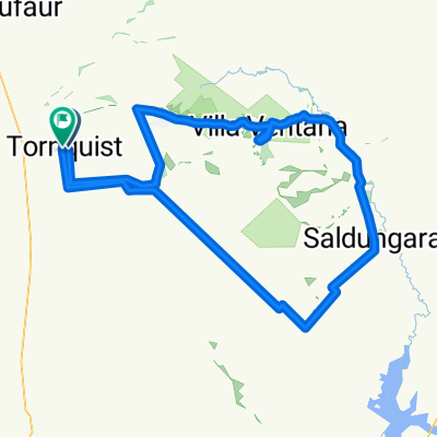
A cycling route starting in Tornquist, Buenos Aires, Argentina.
Overview
About this route
Recorrido Mountain Bike, al Cerro Sombra de Toro, en el Partido de Tornquist, Provincia de Buenos Aires.
Saliendo de la Plaza del Pueblo, tomamos caminos vecinales y pasamos por el 1er Puente donde nace el Arroyo Naposta Grande,, alli mismo esta la entrada a la famosa Estancia Funke, (que lleva al Cerro 3 Picos..) Nuestro camino nos lleva a seguir, un par de km. Por el Camino Abra de los Vascos. luego entramos a otro sendero que sube hasta el pie de Cerro Sombra De Toro. continuando se baja en una gran picada de piedras. lindo descenso, para tomar camino pegado al cero y asi rodearlo... Mas adelante volvemos a cruzar el Naposta y otro afluente, para entrar a Tornquist, por camino paralelo a las vias.. retornando al Punto de salida...Gran Vuelta. muy recomendable.
- -:--
- Duration
- 69 km
- Distance
- 240 m
- Ascent
- 247 m
- Descent
- ---
- Avg. speed
- ---
- Avg. speed
Route photos
Route quality
Waytypes & surfaces along the route
Waytypes
Quiet road
35.7 km
(52 %)
Road
33.2 km
(48 %)
Surfaces
Paved
3.2 km
(5 %)
Unpaved
65.8 km
(95 %)
Unpaved (undefined)
65.8 km
(95 %)
Asphalt
1.9 km
(3 %)
Concrete
1.3 km
(2 %)
Route highlights
Points of interest along the route
Point of interest after 0.3 km
PLAZA de TORNQUIST
Point of interest after 16 km
1er. PUENTE ARROYO NAPOSTA GRANDE desde su nacimiento, montaña arriba.
Point of interest after 16.6 km
ESTANCIA FUNKE
Point of interest after 16.7 km
ESTANCIA FUNKE
Point of interest after 27.6 km
SUBIENDO AL CERRO SOMBRA DE TORO
Point of interest after 66.3 km
CAMINO VECINAL A TORNQUIST
Continue with Bikemap
Use, edit, or download this cycling route
You would like to ride VUELTA al CERRO SOMBRA de TORO- TORNQUIST or customize it for your own trip? Here is what you can do with this Bikemap route:
Free features
- Save this route as favorite or in collections
- Copy & plan your own version of this route
- Sync your route with Garmin or Wahoo
Premium features
Free trial for 3 days, or one-time payment. More about Bikemap Premium.
- Navigate this route on iOS & Android
- Export a GPX / KML file of this route
- Create your custom printout (try it for free)
- Download this route for offline navigation
Discover more Premium features.
Get Bikemap PremiumFrom our community
Other popular routes starting in Tornquist
- ABRA DEL HINOJO--desde DUFAUR
- Distance
- 119.1 km
- Ascent
- 353 m
- Descent
- 352 m
- Location
- Tornquist, Buenos Aires, Argentina
- Vuelta Dufaur 2015
- Distance
- 55.9 km
- Ascent
- 289 m
- Descent
- 291 m
- Location
- Tornquist, Buenos Aires, Argentina
- ◄VUELTA AL CERRO SOMBRA DE TORO►
- Distance
- 69.9 km
- Ascent
- 263 m
- Descent
- 265 m
- Location
- Tornquist, Buenos Aires, Argentina
- DUFAUR-- CICLOTURISMO VUELTA AL CERRO CHACO
- Distance
- 56.3 km
- Ascent
- 323 m
- Descent
- 323 m
- Location
- Tornquist, Buenos Aires, Argentina
- COLONIA SAN MARTIN de TOURS
- Distance
- 57.6 km
- Ascent
- 104 m
- Descent
- 104 m
- Location
- Tornquist, Buenos Aires, Argentina
- Abra del Hinojo por Dufaur
- Distance
- 136.5 km
- Ascent
- 598 m
- Descent
- 597 m
- Location
- Tornquist, Buenos Aires, Argentina
- Vuelta del Abra del Hinojo x Pedales Platenses
- Distance
- 135.6 km
- Ascent
- 591 m
- Descent
- 643 m
- Location
- Tornquist, Buenos Aires, Argentina
- Circuito Chico Villa Ventana
- Distance
- 35.9 km
- Ascent
- 126 m
- Descent
- 126 m
- Location
- Tornquist, Buenos Aires, Argentina
Open it in the app