
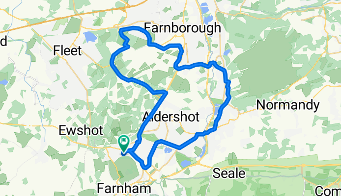
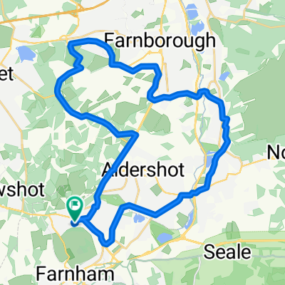
Easy ride in Farnham
A cycling route starting in Hale, England, United Kingdom.
Overview
About this route
- 3 h 13 min
- Duration
- 29.9 km
- Distance
- 228 m
- Ascent
- 228 m
- Descent
- 9.3 km/h
- Avg. speed
- ---
- Max. altitude
Route quality
Waytypes & surfaces along the route
Waytypes
Quiet road
6.3 km
(21 %)
Road
3.3 km
(11 %)
Surfaces
Paved
29 km
(97 %)
Unpaved
0.3 km
(1 %)
Asphalt
29 km
(97 %)
Gravel
0.3 km
(1 %)
Undefined
0.6 km
(2 %)
Continue with Bikemap
Use, edit, or download this cycling route
You would like to ride Easy ride in Farnham or customize it for your own trip? Here is what you can do with this Bikemap route:
Free features
- Save this route as favorite or in collections
- Copy & plan your own version of this route
- Sync your route with Garmin or Wahoo
Premium features
Free trial for 3 days, or one-time payment. More about Bikemap Premium.
- Navigate this route on iOS & Android
- Export a GPX / KML file of this route
- Create your custom printout (try it for free)
- Download this route for offline navigation
Discover more Premium features.
Get Bikemap PremiumFrom our community
Other popular routes starting in Hale
 cross country recce
- Distance
- 4.4 km
- Ascent
- 65 m
- Descent
- 27 m
- Location
- Hale, England, United Kingdom
 Fab off road route... a couple of punctures!!!!
- Distance
- 56.9 km
- Ascent
- 50 m
- Descent
- 96 m
- Location
- Hale, England, United Kingdom
 23 + mile loop Puttenham, Normandy, Ash Vale
- Distance
- 38.1 km
- Ascent
- 178 m
- Descent
- 174 m
- Location
- Hale, England, United Kingdom
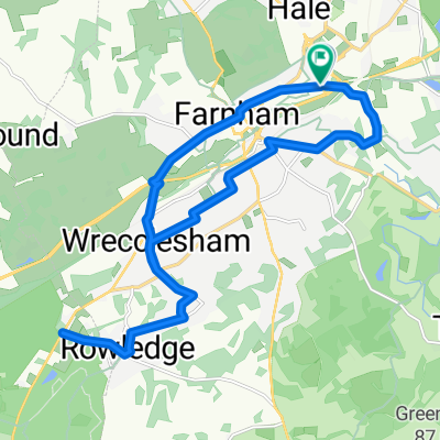 Rowledge and back
- Distance
- 17.8 km
- Ascent
- 132 m
- Descent
- 132 m
- Location
- Hale, England, United Kingdom
 Bourley Road to Bourley Lane
- Distance
- 4.4 km
- Ascent
- 110 m
- Descent
- 113 m
- Location
- Hale, England, United Kingdom
 North Avenue 16 to North Avenue 16
- Distance
- 16.7 km
- Ascent
- 164 m
- Descent
- 165 m
- Location
- Hale, England, United Kingdom
 Easy ride in Farnham
- Distance
- 29.9 km
- Ascent
- 228 m
- Descent
- 228 m
- Location
- Hale, England, United Kingdom
 Axford, Medstead, Lasham, Alton, Rowledge
- Distance
- 79.7 km
- Ascent
- 548 m
- Descent
- 548 m
- Location
- Hale, England, United Kingdom
Open it in the app