

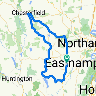
Peace Pagoda & River Farmland - Easthampton
A cycling route starting in Easthampton, Massachusetts, United States of America.
Overview
About this route
- -:--
- Duration
- 79.9 km
- Distance
- 342 m
- Ascent
- 341 m
- Descent
- ---
- Avg. speed
- ---
- Max. altitude

Route quality
Waytypes & surfaces along the route
Waytypes
Busy road
40.6 km
(51 %)
Cycleway
21.2 km
(26 %)
Surfaces
Paved
38.3 km
(48 %)
Unpaved
2.6 km
(3 %)
Asphalt
26.2 km
(33 %)
Paved (undefined)
11.5 km
(14 %)
Continue with Bikemap
Use, edit, or download this cycling route
You would like to ride Peace Pagoda & River Farmland - Easthampton or customize it for your own trip? Here is what you can do with this Bikemap route:
Free features
- Save this route as favorite or in collections
- Copy & plan your own version of this route
- Sync your route with Garmin or Wahoo
Premium features
Free trial for 3 days, or one-time payment. More about Bikemap Premium.
- Navigate this route on iOS & Android
- Export a GPX / KML file of this route
- Create your custom printout (try it for free)
- Download this route for offline navigation
Discover more Premium features.
Get Bikemap PremiumFrom our community
Other popular routes starting in Easthampton
 69 Ferry St, Easthampton to 228 Northampton St, Easthampton
- Distance
- 40.4 km
- Ascent
- 566 m
- Descent
- 551 m
- Location
- Easthampton, Massachusetts, United States of America
 125 Reservation Rd, Holyoke to 37 Portland St, Holyoke
- Distance
- 11.8 km
- Ascent
- 183 m
- Descent
- 236 m
- Location
- Easthampton, Massachusetts, United States of America
 6 Coleman Rd, Southampton to 6 Coleman Rd, Southampton
- Distance
- 47.5 km
- Ascent
- 269 m
- Descent
- 269 m
- Location
- Easthampton, Massachusetts, United States of America
 Shortened Mini Fundo 55k
- Distance
- 55 km
- Ascent
- 705 m
- Descent
- 694 m
- Location
- Easthampton, Massachusetts, United States of America
 Skyline Trail from NOHO
- Distance
- 107.7 km
- Ascent
- 1,251 m
- Descent
- 1,246 m
- Location
- Easthampton, Massachusetts, United States of America
 Mt Tom loop
- Distance
- 12.9 km
- Ascent
- 191 m
- Descent
- 191 m
- Location
- Easthampton, Massachusetts, United States of America
 Crooked ledges North Island
- Distance
- 71.5 km
- Ascent
- 1,423 m
- Descent
- 1,426 m
- Location
- Easthampton, Massachusetts, United States of America
 Peace Pagoda & River Farmland - Easthampton
- Distance
- 79.9 km
- Ascent
- 342 m
- Descent
- 341 m
- Location
- Easthampton, Massachusetts, United States of America
Open it in the app