

Deep Creek and Back
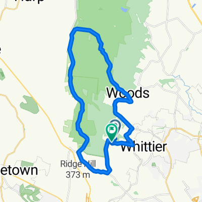
Day Two Western MD Run
A cycling route starting in Clover Hill, Maryland, United States.
Overview
About this route
Frederick Maryland to Berkeley Springs, West Virginia
- -:--
- Duration
- 98.7 km
- Distance
- 837 m
- Ascent
- 754 m
- Descent
- ---
- Avg. speed
- ---
- Max. altitude

Part of
Deep Creek and Back
6 stages
Continue with Bikemap
Use, edit, or download this cycling route
You would like to ride Day Two Western MD Run or customize it for your own trip? Here is what you can do with this Bikemap route:
Free features
- Save this route as favorite or in collections
- Copy & plan your own version of this route
- Split it into stages to create a multi-day tour
- Sync your route with Garmin or Wahoo
Premium features
Free trial for 3 days, or one-time payment. More about Bikemap Premium.
- Navigate this route on iOS & Android
- Export a GPX / KML file of this route
- Create your custom printout (try it for free)
- Download this route for offline navigation
Discover more Premium features.
Get Bikemap PremiumFrom our community
Other popular routes starting in Clover Hill
 Mountain Ride - Home
- Distance
- 10 km
- Ascent
- 176 m
- Descent
- 176 m
- Location
- Clover Hill, Maryland, United States
 Route from 7820 Wormans Mill Rd, Frederick
- Distance
- 86.9 km
- Ascent
- 916 m
- Descent
- 917 m
- Location
- Clover Hill, Maryland, United States
 Putt Puttin’ north of town
- Distance
- 26.2 km
- Ascent
- 340 m
- Descent
- 330 m
- Location
- Clover Hill, Maryland, United States
 Edgewood through Gambrill
- Distance
- 23.9 km
- Ascent
- 504 m
- Descent
- 517 m
- Location
- Clover Hill, Maryland, United States
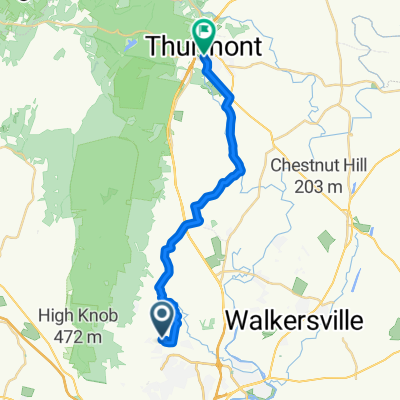 From Frederick to Thurmont
- Distance
- 22.5 km
- Ascent
- 143 m
- Descent
- 128 m
- Location
- Clover Hill, Maryland, United States
 WTF was I thinking but it was fun
- Distance
- 40.3 km
- Ascent
- 722 m
- Descent
- 733 m
- Location
- Clover Hill, Maryland, United States
 Southern Frederick County Loop
- Distance
- 65.3 km
- Ascent
- 541 m
- Descent
- 541 m
- Location
- Clover Hill, Maryland, United States
 OMG WTF
- Distance
- 109.4 km
- Ascent
- 1,421 m
- Descent
- 1,424 m
- Location
- Clover Hill, Maryland, United States
Open it in the app