
Re-OO Trail
A cycling route starting in Ottendorf-Okrilla, Saxony, Germany.
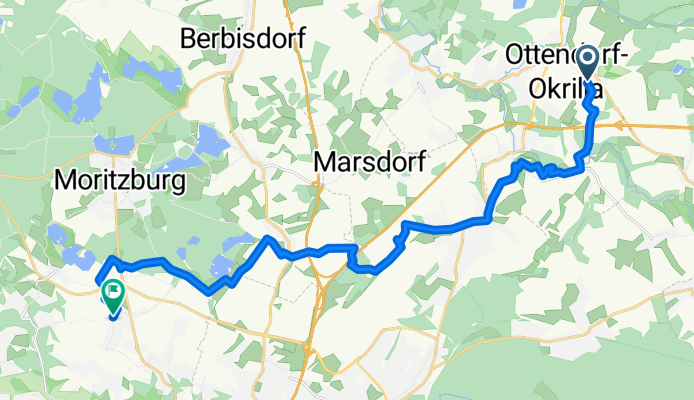
Overview
About this route
Traumhafte Landstaft und perfekte Strecke für Mountenbiker, idealer Zubringer für Moritzburg oder Seifersdorfer Tal.
- -:--
- Duration
- 20.1 km
- Distance
- 135 m
- Ascent
- 119 m
- Descent
- ---
- Avg. speed
- ---
- Max. altitude

Continue with Bikemap
Use, edit, or download this cycling route
You would like to ride Re-OO Trail or customize it for your own trip? Here is what you can do with this Bikemap route:
Free features
- Save this route as favorite or in collections
- Copy & plan your own version of this route
- Sync your route with Garmin or Wahoo
Premium features
Free trial for 3 days, or one-time payment. More about Bikemap Premium.
- Navigate this route on iOS & Android
- Export a GPX / KML file of this route
- Create your custom printout (try it for free)
- Download this route for offline navigation
Discover more Premium features.
Get Bikemap PremiumFrom our community
Other popular routes starting in Ottendorf-Okrilla
 Dresden - Heiderunde mit Singletrails
- Distance
- 33.8 km
- Ascent
- 282 m
- Descent
- 276 m
- Location
- Ottendorf-Okrilla, Saxony, Germany
 Feierabend LB-DD-RBG
- Distance
- 31.1 km
- Ascent
- 261 m
- Descent
- 257 m
- Location
- Ottendorf-Okrilla, Saxony, Germany
 MED_Döl
- Distance
- 44.7 km
- Ascent
- 288 m
- Descent
- 295 m
- Location
- Ottendorf-Okrilla, Saxony, Germany
 Weixdorf - Zschornaer Teiche - Schloß Schönfeld u. zur.
- Distance
- 52.8 km
- Ascent
- 297 m
- Descent
- 295 m
- Location
- Ottendorf-Okrilla, Saxony, Germany
 Langebrück-Keulenberg
- Distance
- 25.4 km
- Ascent
- 286 m
- Descent
- 144 m
- Location
- Ottendorf-Okrilla, Saxony, Germany
 Re-OO Trail
- Distance
- 20.1 km
- Ascent
- 135 m
- Descent
- 119 m
- Location
- Ottendorf-Okrilla, Saxony, Germany
 Sonntagstour im Dresdner Norden
- Distance
- 50.8 km
- Ascent
- 392 m
- Descent
- 393 m
- Location
- Ottendorf-Okrilla, Saxony, Germany
 Langebrück-Bad Schandau- das X
- Distance
- 119.3 km
- Ascent
- 1,503 m
- Descent
- 1,467 m
- Location
- Ottendorf-Okrilla, Saxony, Germany
Open it in the app