

Günztal-Radweg
A cycling route starting in Günzach, Bavaria, Germany.
Overview
About this route
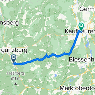
The Günztal cycle path leads from its source in Ostallgäu's Günzach over about 92 km to Günzburg, where it flows into the Danube. Along the route, beautiful churches and castles are embedded in the varied landscape. The flora and fauna along the Günz are particularly noteworthy, as they remain untouched in many sections.
- 6 h 6 min
- Duration
- 92.7 km
- Distance
- 128 m
- Ascent
- 494 m
- Descent
- 15.2 km/h
- Avg. speed
- ---
- Max. altitude
Route quality
Waytypes & surfaces along the route
Waytypes
Quiet road
41.7 km
(45 %)
Track
30.6 km
(33 %)
Surfaces
Paved
41.7 km
(45 %)
Unpaved
20.4 km
(22 %)
Asphalt
27.8 km
(30 %)
Gravel
20.4 km
(22 %)
Continue with Bikemap
Use, edit, or download this cycling route
You would like to ride Günztal-Radweg or customize it for your own trip? Here is what you can do with this Bikemap route:
Free features
- Save this route as favorite or in collections
- Copy & plan your own version of this route
- Split it into stages to create a multi-day tour
- Sync your route with Garmin or Wahoo
Premium features
Free trial for 3 days, or one-time payment. More about Bikemap Premium.
- Navigate this route on iOS & Android
- Export a GPX / KML file of this route
- Create your custom printout (try it for free)
- Download this route for offline navigation
Discover more Premium features.
Get Bikemap PremiumFrom our community
Other popular routes starting in Günzach
 Allgäu-Mindelquelle Illertissen
- Distance
- 84.1 km
- Ascent
- 1,731 m
- Descent
- 2,020 m
- Location
- Günzach, Bavaria, Germany
 Günz-Radweg CLONED FROM ROUTE 78942
- Distance
- 86.7 km
- Ascent
- 265 m
- Descent
- 564 m
- Location
- Günzach, Bavaria, Germany
 Gunzach to Imst
- Distance
- 108.9 km
- Ascent
- 923 m
- Descent
- 939 m
- Location
- Günzach, Bavaria, Germany
 Günztalrunde
- Distance
- 33.5 km
- Ascent
- 287 m
- Descent
- 287 m
- Location
- Günzach, Bavaria, Germany
 St2012 1, Günzach nach Auweg 9, Günzburg
- Distance
- 91.3 km
- Ascent
- 490 m
- Descent
- 837 m
- Location
- Günzach, Bavaria, Germany
 Kaufbeuren
- Distance
- 19.1 km
- Ascent
- 171 m
- Descent
- 280 m
- Location
- Günzach, Bavaria, Germany
 Günztal-Radweg
- Distance
- 92.7 km
- Ascent
- 128 m
- Descent
- 494 m
- Location
- Günzach, Bavaria, Germany
 Günzach - Kempten
- Distance
- 17.5 km
- Ascent
- 83 m
- Descent
- 198 m
- Location
- Günzach, Bavaria, Germany
Open it in the app