Schaffhausen - Saar - Trier
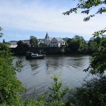
A cycling route starting in Röchling-Höhe, Saarland, Germany.
Overview
About this route
- 8 h 9 min
- Duration
- 90.8 km
- Distance
- 804 m
- Ascent
- 851 m
- Descent
- 11.2 km/h
- Avg. speed
- 192 m
- Avg. speed
Route quality
Waytypes & surfaces along the route
Waytypes
Path
32.3 km
(36 %)
Access road
19.7 km
(22 %)
Surfaces
Paved
75.5 km
(83 %)
Unpaved
9.3 km
(10 %)
Asphalt
59 km
(65 %)
Gravel
6.7 km
(7 %)
Continue with Bikemap
Use, edit, or download this cycling route
You would like to ride Schaffhausen - Saar - Trier or customize it for your own trip? Here is what you can do with this Bikemap route:
Free features
- Save this route as favorite or in collections
- Copy & plan your own version of this route
- Sync your route with Garmin or Wahoo
Premium features
Free trial for 3 days, or one-time payment. More about Bikemap Premium.
- Navigate this route on iOS & Android
- Export a GPX / KML file of this route
- Create your custom printout (try it for free)
- Download this route for offline navigation
Discover more Premium features.
Get Bikemap PremiumFrom our community
Other popular routes starting in Röchling-Höhe
- Trierer Straße 36, Völklingen nach L139 22, Saarlouis
- Distance
- 32.8 km
- Ascent
- 250 m
- Descent
- 416 m
- Location
- Röchling-Höhe, Saarland, Germany
- GraphHopper Track
- Distance
- 12.4 km
- Ascent
- 128 m
- Descent
- 174 m
- Location
- Röchling-Höhe, Saarland, Germany
- Petershof 1, Bous nach Im Sportzentrum, Ensdorf
- Distance
- 8.3 km
- Ascent
- 152 m
- Descent
- 212 m
- Location
- Röchling-Höhe, Saarland, Germany
- Schaffhausen - Saar - Trier
- Distance
- 90.8 km
- Ascent
- 804 m
- Descent
- 851 m
- Location
- Röchling-Höhe, Saarland, Germany
- Strecke
- Distance
- 21.4 km
- Ascent
- 133 m
- Descent
- 189 m
- Location
- Röchling-Höhe, Saarland, Germany
- Petershof - Elm
- Distance
- 7.5 km
- Ascent
- 114 m
- Descent
- 106 m
- Location
- Röchling-Höhe, Saarland, Germany
- Entspannende Route in Saarlouis
- Distance
- 8.8 km
- Ascent
- 23 m
- Descent
- 26 m
- Location
- Röchling-Höhe, Saarland, Germany
- Röntgenstraße 96, Völklingen nach Hirtenstraße 2, Völklingen
- Distance
- 19 km
- Ascent
- 30 m
- Descent
- 95 m
- Location
- Röchling-Höhe, Saarland, Germany
Open it in the app