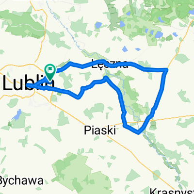
nad wode
A cycling route starting in Jakubowice Murowane, Lublin Voivodeship, Poland.
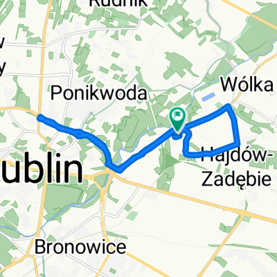
Overview
About this route
The more information you provide HERE, the more you will help other users using your route.
- Route description.
- What is special about this route?
- Why do you recommend this route?
- What attractions are there?
- etc.
- -:--
- Duration
- 125.6 km
- Distance
- 102 m
- Ascent
- 137 m
- Descent
- ---
- Avg. speed
- ---
- Max. altitude
Continue with Bikemap
Use, edit, or download this cycling route
You would like to ride nad wode or customize it for your own trip? Here is what you can do with this Bikemap route:
Free features
- Save this route as favorite or in collections
- Copy & plan your own version of this route
- Split it into stages to create a multi-day tour
- Sync your route with Garmin or Wahoo
Premium features
Free trial for 3 days, or one-time payment. More about Bikemap Premium.
- Navigate this route on iOS & Android
- Export a GPX / KML file of this route
- Create your custom printout (try it for free)
- Download this route for offline navigation
Discover more Premium features.
Get Bikemap PremiumFrom our community
Other popular routes starting in Jakubowice Murowane
- Koncpecja szlaku stacja PKP Ciecierzyn-szl. niebieski
- Distance
- 2.3 km
- Ascent
- 0 m
- Descent
- 21 m
- Location
- Jakubowice Murowane, Lublin Voivodeship, Poland
- Lublin-WolaUhruska
- Distance
- 108.3 km
- Ascent
- 165 m
- Descent
- 128 m
- Location
- Jakubowice Murowane, Lublin Voivodeship, Poland
- nad wode
- Distance
- 125.6 km
- Ascent
- 102 m
- Descent
- 137 m
- Location
- Jakubowice Murowane, Lublin Voivodeship, Poland
- Parczew 2017 dzień 2
- Distance
- 82.2 km
- Ascent
- 80 m
- Descent
- 109 m
- Location
- Jakubowice Murowane, Lublin Voivodeship, Poland
- 2010.06.04
- Distance
- 107.5 km
- Ascent
- 102 m
- Descent
- 105 m
- Location
- Jakubowice Murowane, Lublin Voivodeship, Poland
- Szlak Gminy Niemce - zmodyfikowany
- Distance
- 50 km
- Ascent
- 149 m
- Descent
- 149 m
- Location
- Jakubowice Murowane, Lublin Voivodeship, Poland
- Dys-Firlej przez Lubartów
- Distance
- 75.5 km
- Ascent
- 151 m
- Descent
- 149 m
- Location
- Jakubowice Murowane, Lublin Voivodeship, Poland
- Dys-Lasy Kozłowieckie-Samoklęski-Stary Tartak-Dys
- Distance
- 55.7 km
- Ascent
- 172 m
- Descent
- 184 m
- Location
- Jakubowice Murowane, Lublin Voivodeship, Poland
Open it in the app