

Grabowicka 23F, Czechowice-Dziedzice do Grabowicka 23F, Czechowice-Dziedzice
A cycling route starting in Czechowice-Dziedzice, Silesian Voivodeship, Poland.
Overview
About this route
- 4 h 4 min
- Duration
- 71.2 km
- Distance
- 227 m
- Ascent
- 225 m
- Descent
- 17.5 km/h
- Avg. speed
- ---
- Max. altitude

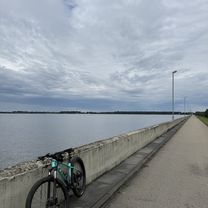
Route photos


Route quality
Waytypes & surfaces along the route
Waytypes
Quiet road
34.9 km
(49 %)
Track
15.7 km
(22 %)
Surfaces
Paved
39.9 km
(56 %)
Unpaved
14.2 km
(20 %)
Asphalt
37.7 km
(53 %)
Ground
6.4 km
(9 %)
Continue with Bikemap
Use, edit, or download this cycling route
You would like to ride Grabowicka 23F, Czechowice-Dziedzice do Grabowicka 23F, Czechowice-Dziedzice or customize it for your own trip? Here is what you can do with this Bikemap route:
Free features
- Save this route as favorite or in collections
- Copy & plan your own version of this route
- Sync your route with Garmin or Wahoo
Premium features
Free trial for 3 days, or one-time payment. More about Bikemap Premium.
- Navigate this route on iOS & Android
- Export a GPX / KML file of this route
- Create your custom printout (try it for free)
- Download this route for offline navigation
Discover more Premium features.
Get Bikemap PremiumFrom our community
Other popular routes starting in Czechowice-Dziedzice
 Towarowa, Czechowice-Dziedzice do R Traugutta, Czechowice-Dziedzice
- Distance
- 50 km
- Ascent
- 274 m
- Descent
- 278 m
- Location
- Czechowice-Dziedzice, Silesian Voivodeship, Poland
 Pętla (Czechowice-Bielsko)
- Distance
- 46.2 km
- Ascent
- 332 m
- Descent
- 333 m
- Location
- Czechowice-Dziedzice, Silesian Voivodeship, Poland
 Dookoła zapory
- Distance
- 49.3 km
- Ascent
- 101 m
- Descent
- 99 m
- Location
- Czechowice-Dziedzice, Silesian Voivodeship, Poland
 Dwa jeziora.
- Distance
- 65.1 km
- Ascent
- 179 m
- Descent
- 180 m
- Location
- Czechowice-Dziedzice, Silesian Voivodeship, Poland
 Grabowicka 23F, Czechowice-Dziedzice do Grabowicka 23F, Czechowice-Dziedzice
- Distance
- 71.2 km
- Ascent
- 227 m
- Descent
- 225 m
- Location
- Czechowice-Dziedzice, Silesian Voivodeship, Poland
 czechowice-dziedzice
- Distance
- 39.7 km
- Ascent
- 87 m
- Descent
- 86 m
- Location
- Czechowice-Dziedzice, Silesian Voivodeship, Poland
 Przeciągnięta pętla Zbiornik Goczałkowicki
- Distance
- 83.1 km
- Ascent
- 81 m
- Descent
- 81 m
- Location
- Czechowice-Dziedzice, Silesian Voivodeship, Poland
 Pętla (Czechowice-Kobiór-Tychy-Łąka)
- Distance
- 78.1 km
- Ascent
- 174 m
- Descent
- 177 m
- Location
- Czechowice-Dziedzice, Silesian Voivodeship, Poland
Open it in the app