
Glocknerrunde
A cycling route starting in Bad Gastein, Salzburg, Austria.
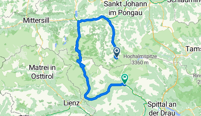
Overview
About this route
In Obervellach Quartier beziehen und dann mit den Bus zur Tauernschleuse und durch den Berg, und dann gehts los.
- -:--
- Duration
- 146.5 km
- Distance
- 1,918 m
- Ascent
- 2,404 m
- Descent
- ---
- Avg. speed
- ---
- Avg. speed

Route quality
Waytypes & surfaces along the route
Waytypes
Busy road
80.5 km
(55 %)
Road
50.7 km
(35 %)
Surfaces
Paved
105.4 km
(72 %)
Unpaved
0.1 km
(<1 %)
Asphalt
105.2 km
(72 %)
Paved (undefined)
0.2 km
(<1 %)
Continue with Bikemap
Use, edit, or download this cycling route
You would like to ride Glocknerrunde or customize it for your own trip? Here is what you can do with this Bikemap route:
Free features
- Save this route as favorite or in collections
- Copy & plan your own version of this route
- Split it into stages to create a multi-day tour
- Sync your route with Garmin or Wahoo
Premium features
Free trial for 3 days, or one-time payment. More about Bikemap Premium.
- Navigate this route on iOS & Android
- Export a GPX / KML file of this route
- Create your custom printout (try it for free)
- Download this route for offline navigation
Discover more Premium features.
Get Bikemap PremiumFrom our community
Other popular routes starting in Bad Gastein
 Bad Gastein - Runde
- Distance
- 54.8 km
- Ascent
- 774 m
- Descent
- 773 m
- Location
- Bad Gastein, Salzburg, Austria
 Alpe Adria Radweg 3 - Bad Gastein nach Millstatt am See
- Distance
- 69.5 km
- Ascent
- 1,107 m
- Descent
- 1,562 m
- Location
- Bad Gastein, Salzburg, Austria
 03 Bad Gastein - Spittal an. d. Drau
- Distance
- 63 km
- Ascent
- 922 m
- Descent
- 1,334 m
- Location
- Bad Gastein, Salzburg, Austria
 Ei Rastötzen
- Distance
- 16.5 km
- Ascent
- 658 m
- Descent
- 668 m
- Location
- Bad Gastein, Salzburg, Austria
 Fundner Heimalm
- Distance
- 13.4 km
- Ascent
- 556 m
- Descent
- 186 m
- Location
- Bad Gastein, Salzburg, Austria
 AAR-5.1 Bad Gastein nach Böckstein
- Distance
- 4.1 km
- Ascent
- 94 m
- Descent
- 9 m
- Location
- Bad Gastein, Salzburg, Austria
 Großglockner Runde, 2. Tag, 2. Etappe
- Distance
- 38.3 km
- Ascent
- 566 m
- Descent
- 968 m
- Location
- Bad Gastein, Salzburg, Austria
 Bad Gastein - Villach
- Distance
- 102.3 km
- Ascent
- 873 m
- Descent
- 1,443 m
- Location
- Bad Gastein, Salzburg, Austria
Open it in the app