

68_2020_Verkeersluwe_fietsroute_Aalten
A cycling route starting in Aalten, Gelderland, The Netherlands.
Overview
About this route
With this cycling route, you will discover a part of the following region: Aalten. Do you sometimes not see the forest for the trees? Then try this forest cycling route. Discover during this route a beautiful monastery: Schaer Monastery. The cycling route starts at the parking lot.
- -:--
- Duration
- 29.8 km
- Distance
- 86 m
- Ascent
- 84 m
- Descent
- ---
- Avg. speed
- ---
- Max. altitude
Route quality
Waytypes & surfaces along the route
Waytypes
Quiet road
11.6 km
(39 %)
Road
7.5 km
(25 %)
Surfaces
Paved
15.2 km
(51 %)
Unpaved
7.5 km
(25 %)
Asphalt
15.2 km
(51 %)
Loose gravel
3.3 km
(11 %)
Continue with Bikemap
Use, edit, or download this cycling route
You would like to ride 68_2020_Verkeersluwe_fietsroute_Aalten or customize it for your own trip? Here is what you can do with this Bikemap route:
Free features
- Save this route as favorite or in collections
- Copy & plan your own version of this route
- Sync your route with Garmin or Wahoo
Premium features
Free trial for 3 days, or one-time payment. More about Bikemap Premium.
- Navigate this route on iOS & Android
- Export a GPX / KML file of this route
- Create your custom printout (try it for free)
- Download this route for offline navigation
Discover more Premium features.
Get Bikemap PremiumFrom our community
Other popular routes starting in Aalten
 68_2020_Verkeersluwe_fietsroute_Aalten
- Distance
- 29.8 km
- Ascent
- 86 m
- Descent
- 84 m
- Location
- Aalten, Gelderland, The Netherlands
 zaterdag 8 januari
- Distance
- 110.2 km
- Ascent
- 77 m
- Descent
- 83 m
- Location
- Aalten, Gelderland, The Netherlands
 Stationsstraat, Aalten to Kerkstraat, Bredevoort
- Distance
- 4.7 km
- Ascent
- 37 m
- Descent
- 12 m
- Location
- Aalten, Gelderland, The Netherlands
 Aalten
- Distance
- 71.1 km
- Ascent
- 75 m
- Descent
- 75 m
- Location
- Aalten, Gelderland, The Netherlands
 Jaarafsluitingsroute
- Distance
- 2.8 km
- Ascent
- 10 m
- Descent
- 7 m
- Location
- Aalten, Gelderland, The Netherlands
 Kanjers zaterdag 6 feb
- Distance
- 116.8 km
- Ascent
- 268 m
- Descent
- 285 m
- Location
- Aalten, Gelderland, The Netherlands
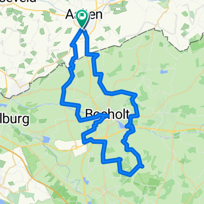 A. Rondje Bocholt
- Distance
- 53.7 km
- Ascent
- 122 m
- Descent
- 121 m
- Location
- Aalten, Gelderland, The Netherlands
 Dinxperlo- Bredevoort
- Distance
- 38.2 km
- Ascent
- 31 m
- Descent
- 30 m
- Location
- Aalten, Gelderland, The Netherlands
Open it in the app