

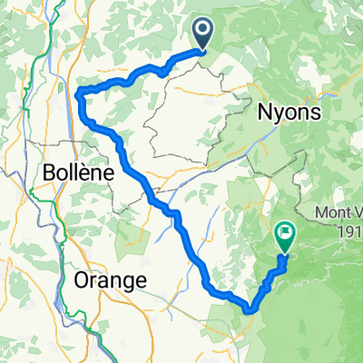
TAULIGNAN allex TAULIGNAN
A cycling route starting in Taulignan, Auvergne-Rhône-Alpes, France.
Overview
About this route
- 8 h 32 min
- Duration
- 134.5 km
- Distance
- 870 m
- Ascent
- 870 m
- Descent
- 15.8 km/h
- Avg. speed
- ---
- Max. altitude
Route quality
Waytypes & surfaces along the route
Waytypes
Road
65 km
(48 %)
Quiet road
54.1 km
(40 %)
Surfaces
Paved
63 km
(47 %)
Unpaved
1.8 km
(1 %)
Asphalt
59.4 km
(44 %)
Paved (undefined)
2.5 km
(2 %)
Continue with Bikemap
Use, edit, or download this cycling route
You would like to ride TAULIGNAN allex TAULIGNAN or customize it for your own trip? Here is what you can do with this Bikemap route:
Free features
- Save this route as favorite or in collections
- Copy & plan your own version of this route
- Split it into stages to create a multi-day tour
- Sync your route with Garmin or Wahoo
Premium features
Free trial for 3 days, or one-time payment. More about Bikemap Premium.
- Navigate this route on iOS & Android
- Export a GPX / KML file of this route
- Create your custom printout (try it for free)
- Download this route for offline navigation
Discover more Premium features.
Get Bikemap PremiumFrom our community
Other popular routes starting in Taulignan
 Valréas
- Distance
- 34 km
- Ascent
- 262 m
- Descent
- 262 m
- Location
- Taulignan, Auvergne-Rhône-Alpes, France
 Dieulefit
- Distance
- 51.2 km
- Ascent
- 566 m
- Descent
- 565 m
- Location
- Taulignan, Auvergne-Rhône-Alpes, France
 100 bornes retour vent de dos
- Distance
- 99.8 km
- Ascent
- 1,050 m
- Descent
- 1,050 m
- Location
- Taulignan, Auvergne-Rhône-Alpes, France
 taulignan malaucene
- Distance
- 84.8 km
- Ascent
- 702 m
- Descent
- 757 m
- Location
- Taulignan, Auvergne-Rhône-Alpes, France
 Ballade avec Christine et Michel
- Distance
- 43.5 km
- Ascent
- 324 m
- Descent
- 328 m
- Location
- Taulignan, Auvergne-Rhône-Alpes, France
 fffgfg
- Distance
- 13.8 km
- Ascent
- 212 m
- Descent
- 201 m
- Location
- Taulignan, Auvergne-Rhône-Alpes, France
 Tour de la montagne de Vesc
- Distance
- 71.2 km
- Ascent
- 1,022 m
- Descent
- 1,022 m
- Location
- Taulignan, Auvergne-Rhône-Alpes, France
 Taulignan Valreas Visan Grignan Taulignan
- Distance
- 49.7 km
- Ascent
- 196 m
- Descent
- 205 m
- Location
- Taulignan, Auvergne-Rhône-Alpes, France
Open it in the app