

Tour 2
A cycling route starting in Frankenmarkt, Upper Austria, Austria.
Overview
About this route
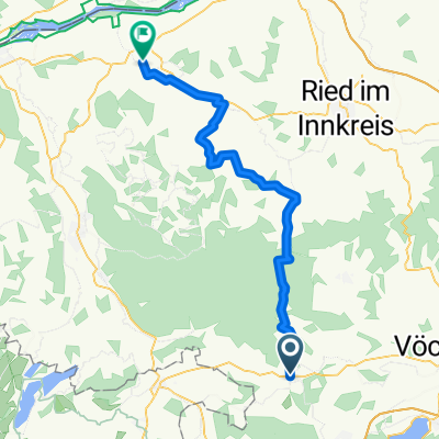
Frankenmarkt - Moos - Brandstatt - Weißenkirchen - Stadln - Reitzing - Oberhofen - Laiter - (mondseeradweg) - Irrsee entlang - Fischhof - Sonnleiten - Vetterbach - Thalgau - Fuschl am See - St. Gilgen - Scharfling/ Oberburgau - Unterach - Buchenort - (am Attersee entlang) Parschnallen - Altenberg - ABtsdorf - Wildenhag - Erlat - Buch - Frankenmarkt
- -:--
- Duration
- 102.7 km
- Distance
- 1,026 m
- Ascent
- 1,034 m
- Descent
- ---
- Avg. speed
- ---
- Max. altitude

Route quality
Waytypes & surfaces along the route
Waytypes
Road
31.8 km
(31 %)
Quiet road
28.8 km
(28 %)
Surfaces
Paved
50.3 km
(49 %)
Unpaved
1 km
(1 %)
Asphalt
50.3 km
(49 %)
Gravel
1 km
(1 %)
Undefined
51.4 km
(50 %)
Continue with Bikemap
Use, edit, or download this cycling route
You would like to ride Tour 2 or customize it for your own trip? Here is what you can do with this Bikemap route:
Free features
- Save this route as favorite or in collections
- Copy & plan your own version of this route
- Split it into stages to create a multi-day tour
- Sync your route with Garmin or Wahoo
Premium features
Free trial for 3 days, or one-time payment. More about Bikemap Premium.
- Navigate this route on iOS & Android
- Export a GPX / KML file of this route
- Create your custom printout (try it for free)
- Download this route for offline navigation
Discover more Premium features.
Get Bikemap PremiumFrom our community
Other popular routes starting in Frankenmarkt
 Haslaurunde 1
- Distance
- 61 km
- Ascent
- 886 m
- Descent
- 886 m
- Location
- Frankenmarkt, Upper Austria, Austria
 Haslaurunde 2
- Distance
- 66.6 km
- Ascent
- 531 m
- Descent
- 531 m
- Location
- Frankenmarkt, Upper Austria, Austria
 GTRAce Frankenmarkt
- Distance
- 46.1 km
- Ascent
- 624 m
- Descent
- 624 m
- Location
- Frankenmarkt, Upper Austria, Austria
 Haslaurunde 3
- Distance
- 49.2 km
- Ascent
- 769 m
- Descent
- 768 m
- Location
- Frankenmarkt, Upper Austria, Austria
 Tour 2
- Distance
- 102.7 km
- Ascent
- 1,026 m
- Descent
- 1,034 m
- Location
- Frankenmarkt, Upper Austria, Austria
 Td98_4. den Frankenmark - Hochtor
- Distance
- 161.7 km
- Ascent
- 2,354 m
- Descent
- 511 m
- Location
- Frankenmarkt, Upper Austria, Austria
 Schnelle Ausfahrt durch Frankenmarkt
- Distance
- 4.3 km
- Ascent
- 45 m
- Descent
- 43 m
- Location
- Frankenmarkt, Upper Austria, Austria
 Innviertel 2019 - 5a
- Distance
- 49 km
- Ascent
- 362 m
- Descent
- 539 m
- Location
- Frankenmarkt, Upper Austria, Austria
Open it in the app