

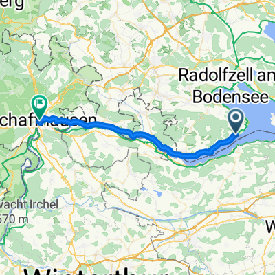
4 Friends
A cycling route starting in Gaienhofen, Baden-Wurttemberg, Germany.
Overview
About this route
- -:--
- Duration
- 62.9 km
- Distance
- 304 m
- Ascent
- 257 m
- Descent
- ---
- Avg. speed
- ---
- Max. altitude

Route quality
Waytypes & surfaces along the route
Waytypes
Path
20.1 km
(32 %)
Quiet road
17.6 km
(28 %)
Surfaces
Paved
52.9 km
(84 %)
Unpaved
8.8 km
(14 %)
Asphalt
51.6 km
(82 %)
Gravel
6.3 km
(10 %)
Continue with Bikemap
Use, edit, or download this cycling route
You would like to ride 4 Friends or customize it for your own trip? Here is what you can do with this Bikemap route:
Free features
- Save this route as favorite or in collections
- Copy & plan your own version of this route
- Sync your route with Garmin or Wahoo
Premium features
Free trial for 3 days, or one-time payment. More about Bikemap Premium.
- Navigate this route on iOS & Android
- Export a GPX / KML file of this route
- Create your custom printout (try it for free)
- Download this route for offline navigation
Discover more Premium features.
Get Bikemap PremiumFrom our community
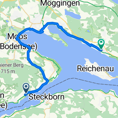
Other popular routes starting in Gaienhofen
 4 Friends
- Distance
- 62.9 km
- Ascent
- 304 m
- Descent
- 257 m
- Location
- Gaienhofen, Baden-Wurttemberg, Germany
 Hauptstraße, Gaienhofen nach Steigstrasse, Schaffhausen
- Distance
- 32.2 km
- Ascent
- 327 m
- Descent
- 293 m
- Location
- Gaienhofen, Baden-Wurttemberg, Germany
 7 Von Gaienhofen bis Feuerthalen
- Distance
- 32.2 km
- Ascent
- 338 m
- Descent
- 313 m
- Location
- Gaienhofen, Baden-Wurttemberg, Germany
 Von Öhningen bis Allensbach
- Distance
- 24.3 km
- Ascent
- 111 m
- Descent
- 146 m
- Location
- Gaienhofen, Baden-Wurttemberg, Germany
 Höri 1
- Distance
- 31.7 km
- Ascent
- 447 m
- Descent
- 463 m
- Location
- Gaienhofen, Baden-Wurttemberg, Germany
 Um Reichenau
- Distance
- 70.9 km
- Ascent
- 336 m
- Descent
- 351 m
- Location
- Gaienhofen, Baden-Wurttemberg, Germany
 witthoh
- Distance
- 93.9 km
- Ascent
- 1,008 m
- Descent
- 1,019 m
- Location
- Gaienhofen, Baden-Wurttemberg, Germany
 Route nach Obergass
- Distance
- 12.8 km
- Ascent
- 137 m
- Descent
- 131 m
- Location
- Gaienhofen, Baden-Wurttemberg, Germany
Open it in the app