2915 Boul de la Pinière, Terrebonne to 185 Rue Durand, Saint-Jérôme
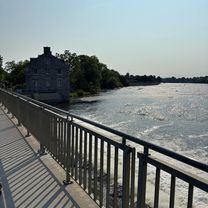
A cycling route starting in Terrebonne, Quebec, Canada.
Overview
About this route
- 1 h 41 min
- Duration
- 30 km
- Distance
- 20 m
- Ascent
- 0 m
- Descent
- 17.9 km/h
- Avg. speed
- ---
- Max. altitude
Route quality
Waytypes & surfaces along the route
Waytypes
Road
18.9 km
(63 %)
Cycleway
9.9 km
(33 %)
Surfaces
Paved
28.8 km
(96 %)
Asphalt
28.8 km
(96 %)
Undefined
1.2 km
(4 %)
Continue with Bikemap
Use, edit, or download this cycling route
You would like to ride 2915 Boul de la Pinière, Terrebonne to 185 Rue Durand, Saint-Jérôme or customize it for your own trip? Here is what you can do with this Bikemap route:
Free features
- Save this route as favorite or in collections
- Copy & plan your own version of this route
- Sync your route with Garmin or Wahoo
Premium features
Free trial for 3 days, or one-time payment. More about Bikemap Premium.
- Navigate this route on iOS & Android
- Export a GPX / KML file of this route
- Create your custom printout (try it for free)
- Download this route for offline navigation
Discover more Premium features.
Get Bikemap PremiumFrom our community
Other popular routes starting in Terrebonne
- ride de terrebonne a St-Calixte par Lac Achigan
- Distance
- 110.3 km
- Ascent
- 494 m
- Descent
- 494 m
- Location
- Terrebonne, Quebec, Canada
- Rue de la Mistassini, Terrebonne à Aut Jean-Lesage, Boucherville
- Distance
- 45.8 km
- Ascent
- 142 m
- Descent
- 172 m
- Location
- Terrebonne, Quebec, Canada
- 2915 Boul de la Pinière, Terrebonne to 185 Rue Durand, Saint-Jérôme
- Distance
- 30 km
- Ascent
- 20 m
- Descent
- 0 m
- Location
- Terrebonne, Quebec, Canada
- trail laplaine
- Distance
- 9.4 km
- Ascent
- 222 m
- Descent
- 236 m
- Location
- Terrebonne, Quebec, Canada
- Terrebonne-Seigneurie des plaines-Terrebonne
- Distance
- 56.4 km
- Ascent
- 229 m
- Descent
- 227 m
- Location
- Terrebonne, Quebec, Canada
- Parcours tranquille
- Distance
- 44.1 km
- Ascent
- 44 m
- Descent
- 42 m
- Location
- Terrebonne, Quebec, Canada
- Route to Blainville QC
- Distance
- 32.4 km
- Ascent
- 89 m
- Descent
- 76 m
- Location
- Terrebonne, Quebec, Canada
- De 441 Rue des Érables, Terrebonne à 439 Rue des Érables, Terrebonne
- Distance
- 34 km
- Ascent
- 22 m
- Descent
- 74 m
- Location
- Terrebonne, Quebec, Canada
Open it in the app