

Rund um Apensen 01
A cycling route starting in Apensen, Lower Saxony, Germany.
Overview
About this route
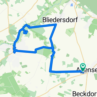
From Apensen to the Goldbecker Heide, there is a circular walk on foot through the heath with a beautiful view of the lake. Then continue to the observation tower on Litberg. Via Sauensiek, head to the manor in Wiegersen and then on to Dannburg. Upon arriving in Beckdorf, continue to Beekhof and then back towards Apensen.
- -:--
- Duration
- 36.3 km
- Distance
- 88 m
- Ascent
- 87 m
- Descent
- ---
- Avg. speed
- ---
- Max. altitude

Route quality
Waytypes & surfaces along the route
Waytypes
Quiet road
16 km
(44 %)
Track
8 km
(22 %)
Surfaces
Paved
22.9 km
(63 %)
Unpaved
2.2 km
(6 %)
Asphalt
20.7 km
(57 %)
Paved (undefined)
2.2 km
(6 %)
Route highlights
Points of interest along the route
Point of interest after 4.4 km
Cafe Tschritter

Point of interest after 8 km
Traumhafter Ausblick

Point of interest after 8.5 km
Goldbecker Heide

Point of interest after 17.3 km
Der Litberg, Aussichtsturm

Point of interest after 22.8 km
Rittergut Wiegersen

Point of interest after 23 km
Rittergut

Point of interest after 25.8 km
Burg

Point of interest after 26.1 km
Burg Dannsee

Point of interest after 30.2 km
Beekhof
Continue with Bikemap
Use, edit, or download this cycling route
You would like to ride Rund um Apensen 01 or customize it for your own trip? Here is what you can do with this Bikemap route:
Free features
- Save this route as favorite or in collections
- Copy & plan your own version of this route
- Sync your route with Garmin or Wahoo
Premium features
Free trial for 3 days, or one-time payment. More about Bikemap Premium.
- Navigate this route on iOS & Android
- Export a GPX / KML file of this route
- Create your custom printout (try it for free)
- Download this route for offline navigation
Discover more Premium features.
Get Bikemap PremiumFrom our community
Other popular routes starting in Apensen
 Route um Immenbeck
- Distance
- 58.9 km
- Ascent
- 97 m
- Descent
- 99 m
- Location
- Apensen, Lower Saxony, Germany
 0 2013 Waldroute Altes Land
- Distance
- 46.3 km
- Ascent
- 106 m
- Descent
- 107 m
- Location
- Apensen, Lower Saxony, Germany
 Buxtehuder Straße 37, Apensen nach Schützenstraße 48, Steinkirchen
- Distance
- 18.3 km
- Ascent
- 35 m
- Descent
- 122 m
- Location
- Apensen, Lower Saxony, Germany
 Waldroute Urlaubsregion Altes Land am Elbstrom
- Distance
- 46.3 km
- Ascent
- 106 m
- Descent
- 107 m
- Location
- Apensen, Lower Saxony, Germany
 Apensen, 21644 Sauensiek, Apensen
- Distance
- 21.8 km
- Ascent
- 94 m
- Descent
- 96 m
- Location
- Apensen, Lower Saxony, Germany
 ApDeinsteAp
- Distance
- 52.8 km
- Ascent
- 97 m
- Descent
- 96 m
- Location
- Apensen, Lower Saxony, Germany
 Rund um Apensen 01
- Distance
- 36.3 km
- Ascent
- 88 m
- Descent
- 87 m
- Location
- Apensen, Lower Saxony, Germany
 Apensen am 03-08-2012
- Distance
- 30.3 km
- Ascent
- 97 m
- Descent
- 96 m
- Location
- Apensen, Lower Saxony, Germany
Open it in the app