

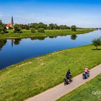
Von Dresden nach Bärwalde u. zurück
A cycling route starting in Dresden, Saxony, Germany.
Overview
About this route
Start/Ziel: Goldener Reiter in DD-N
durch die Neustadt (Alaunstr. u. -park) hinauf nach Hellerau, weiter über Volkersdorf, Berbisdorf nach Bärwalde (schöne Pausenstelle am ganz kleinen Teich); zurück durch den Friedewald nach Moritzburg - weiter zum Ort Friedewald und dann den Lößnitzgrund hinab zum Weißen Roß in Radebeul - weiter nach Serkowiitz (vorbei am Lügenmuseum) und auf dem rechtselbischen Radweg zurück zum Startpunkt
- -:--
- Duration
- 49.1 km
- Distance
- 174 m
- Ascent
- 176 m
- Descent
- ---
- Avg. speed
- ---
- Max. altitude

Route quality
Waytypes & surfaces along the route
Waytypes
Quiet road
17.2 km
(35 %)
Road
7.8 km
(16 %)
Surfaces
Paved
36.8 km
(75 %)
Unpaved
5.9 km
(12 %)
Asphalt
36.8 km
(75 %)
Gravel
2.9 km
(6 %)
Continue with Bikemap
Use, edit, or download this cycling route
You would like to ride Von Dresden nach Bärwalde u. zurück or customize it for your own trip? Here is what you can do with this Bikemap route:
Free features
- Save this route as favorite or in collections
- Copy & plan your own version of this route
- Sync your route with Garmin or Wahoo
Premium features
Free trial for 3 days, or one-time payment. More about Bikemap Premium.
- Navigate this route on iOS & Android
- Export a GPX / KML file of this route
- Create your custom printout (try it for free)
- Download this route for offline navigation
Discover more Premium features.
Get Bikemap PremiumFrom our community
Other popular routes starting in Dresden
 Nachtcruise DLC 14
- Distance
- 16.8 km
- Ascent
- 64 m
- Descent
- 59 m
- Location
- Dresden, Saxony, Germany
 Schönfelder Hochland Hohenstein Rathen
- Distance
- 77.5 km
- Ascent
- 469 m
- Descent
- 472 m
- Location
- Dresden, Saxony, Germany
 Dresden - Berlin Zehlendorf
- Distance
- 205.9 km
- Ascent
- 367 m
- Descent
- 440 m
- Location
- Dresden, Saxony, Germany
 Elbe Cycle Route - Dresden to Magdeburg
- Distance
- 312.5 km
- Ascent
- 538 m
- Descent
- 597 m
- Location
- Dresden, Saxony, Germany
 Dresden-Freital-Dippoldiswalde-Dresden
- Distance
- 64.1 km
- Ascent
- 882 m
- Descent
- 886 m
- Location
- Dresden, Saxony, Germany
 rechts und linkselbische Taeler
- Distance
- 59.5 km
- Ascent
- 677 m
- Descent
- 673 m
- Location
- Dresden, Saxony, Germany
 Erzgebirgstripel
- Distance
- 172 km
- Ascent
- 3,240 m
- Descent
- 3,158 m
- Location
- Dresden, Saxony, Germany
 Stoppomat, Landberg & Klingenberg
- Distance
- 74.7 km
- Ascent
- 477 m
- Descent
- 478 m
- Location
- Dresden, Saxony, Germany
Open it in the app