

Da Ä£*Ô? a Ä£*Ô?
A cycling route starting in Rome, Lazio, Italy.
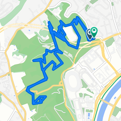
Overview
About this route
- 40 min
- Duration
- 5.3 km
- Distance
- 58 m
- Ascent
- 57 m
- Descent
- 8 km/h
- Avg. speed
- ---
- Max. altitude
Continue with Bikemap
Use, edit, or download this cycling route
You would like to ride Da Ä£*Ô? a Ä£*Ô? or customize it for your own trip? Here is what you can do with this Bikemap route:
Free features
- Save this route as favorite or in collections
- Copy & plan your own version of this route
- Sync your route with Garmin or Wahoo
Premium features
Free trial for 3 days, or one-time payment. More about Bikemap Premium.
- Navigate this route on iOS & Android
- Export a GPX / KML file of this route
- Create your custom printout (try it for free)
- Download this route for offline navigation
Discover more Premium features.
Get Bikemap PremiumFrom our community
Other popular routes starting in Rome
 Lengthy ride through Rome
- Distance
- 41.8 km
- Ascent
- 214 m
- Descent
- 213 m
- Location
- Rome, Lazio, Italy
 Anello Roma Sud Est
- Distance
- 28.2 km
- Ascent
- 140 m
- Descent
- 140 m
- Location
- Rome, Lazio, Italy
 Percorsi Monte Mario
- Distance
- 9.3 km
- Ascent
- 272 m
- Descent
- 289 m
- Location
- Rome, Lazio, Italy
 St. Francesco's Way
- Distance
- 177.7 km
- Ascent
- 1,518 m
- Descent
- 1,157 m
- Location
- Rome, Lazio, Italy
 VILLE ROMANE E ROMA GARIBALDINA
- Distance
- 18.2 km
- Ascent
- 221 m
- Descent
- 209 m
- Location
- Rome, Lazio, Italy
 Giro dei parchi di Roma
- Distance
- 37.7 km
- Ascent
- 342 m
- Descent
- 342 m
- Location
- Rome, Lazio, Italy
 tuscolano - torre maura - parco tor tre teste
- Distance
- 16.1 km
- Ascent
- 61 m
- Descent
- 62 m
- Location
- Rome, Lazio, Italy
 Villa Pamphili East
- Distance
- 3.3 km
- Ascent
- 75 m
- Descent
- 78 m
- Location
- Rome, Lazio, Italy
Open it in the app