

Da Via Casilina 400, Roma a Via Casilina 626, Roma
A cycling route starting in Rome, Lazio, Italy.
Overview
About this route
- 1 h 48 min
- Duration
- 18.4 km
- Distance
- 272 m
- Ascent
- 263 m
- Descent
- 10.3 km/h
- Avg. speed
- ---
- Max. altitude

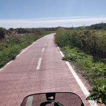
Route photos


Continue with Bikemap
Use, edit, or download this cycling route
You would like to ride Da Via Casilina 400, Roma a Via Casilina 626, Roma or customize it for your own trip? Here is what you can do with this Bikemap route:
Free features
- Save this route as favorite or in collections
- Copy & plan your own version of this route
- Sync your route with Garmin or Wahoo
Premium features
Free trial for 3 days, or one-time payment. More about Bikemap Premium.
- Navigate this route on iOS & Android
- Export a GPX / KML file of this route
- Create your custom printout (try it for free)
- Download this route for offline navigation
Discover more Premium features.
Get Bikemap PremiumFrom our community
Other popular routes starting in Rome
 San giovanni
- Distance
- 12.5 km
- Ascent
- 134 m
- Descent
- 100 m
- Location
- Rome, Lazio, Italy
 ardeatina
- Distance
- 15.3 km
- Ascent
- 102 m
- Descent
- 194 m
- Location
- Rome, Lazio, Italy
 Isola Farnese
- Distance
- 56.9 km
- Ascent
- 338 m
- Descent
- 335 m
- Location
- Rome, Lazio, Italy
 EZF Rom
- Distance
- 19.7 km
- Ascent
- 210 m
- Descent
- 208 m
- Location
- Rome, Lazio, Italy
 ACQUEDOTTI>APPIANTICA>CAFFARELLA
- Distance
- 25.8 km
- Ascent
- 116 m
- Descent
- 115 m
- Location
- Rome, Lazio, Italy
 Roma-giroTuristico
- Distance
- 22.4 km
- Ascent
- 200 m
- Descent
- 197 m
- Location
- Rome, Lazio, Italy
 fede g
- Distance
- 21.7 km
- Ascent
- 154 m
- Descent
- 121 m
- Location
- Rome, Lazio, Italy
 bracciano > tragliata > roma
- Distance
- 67.8 km
- Ascent
- 501 m
- Descent
- 304 m
- Location
- Rome, Lazio, Italy
Open it in the app