

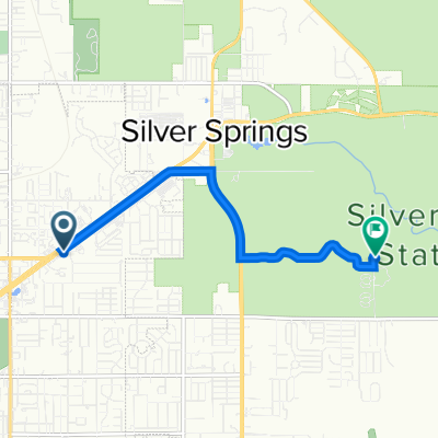
Easy ride in Ocala
A cycling route starting in Ocala, Florida, United States.
Overview
About this route
- 22 min
- Duration
- 4.1 km
- Distance
- 9 m
- Ascent
- 35 m
- Descent
- 11.3 km/h
- Avg. speed
- ---
- Max. altitude

Continue with Bikemap
Use, edit, or download this cycling route
You would like to ride Easy ride in Ocala or customize it for your own trip? Here is what you can do with this Bikemap route:
Free features
- Save this route as favorite or in collections
- Copy & plan your own version of this route
- Sync your route with Garmin or Wahoo
Premium features
Free trial for 3 days, or one-time payment. More about Bikemap Premium.
- Navigate this route on iOS & Android
- Export a GPX / KML file of this route
- Create your custom printout (try it for free)
- Download this route for offline navigation
Discover more Premium features.
Get Bikemap PremiumFrom our community
Other popular routes starting in Ocala
 Ocala to Withlacoochee State Trail, Inverness
- Distance
- 61 km
- Ascent
- 282 m
- Descent
- 285 m
- Location
- Ocala, Florida, United States
 ocala CVS to WMart
- Distance
- 33.2 km
- Ascent
- 82 m
- Descent
- 80 m
- Location
- Ocala, Florida, United States
 9649 SW 82nd Place Rd, Ocala to 9649 SW 82nd Place Rd, Ocala
- Distance
- 8.3 km
- Ascent
- 10 m
- Descent
- 9 m
- Location
- Ocala, Florida, United States
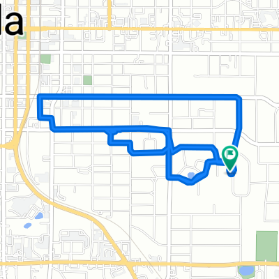
 Silver Springs Park
- Distance
- 6.1 km
- Ascent
- 31 m
- Descent
- 37 m
- Location
- Ocala, Florida, United States
 Ocala to S Lake Trail, Clermont
- Distance
- 134.9 km
- Ascent
- 863 m
- Descent
- 853 m
- Location
- Ocala, Florida, United States
 Easy ride in Ocala
- Distance
- 4.1 km
- Ascent
- 9 m
- Descent
- 35 m
- Location
- Ocala, Florida, United States
 9294 SW 60th Lane Rd, Ocala to 11313 SW 95th Cir, Ocala
- Distance
- 21.3 km
- Ascent
- 94 m
- Descent
- 93 m
- Location
- Ocala, Florida, United States
 Easy ride in Ocala
- Distance
- 7.9 km
- Ascent
- 62 m
- Descent
- 62 m
- Location
- Ocala, Florida, United States
Open it in the app