

Pfünz-Kipfenberg-Runde
A cycling route starting in Wettstetten, Bavaria, Germany.
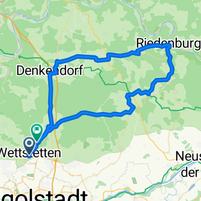
Overview
About this route
From Böhmfeld, the route leads through Katzental to Pfünz. It follows the Camino de Santiago roughly halfway. For those unfamiliar with the area, a topographic map is recommended, as signage is very scarce here. This section also has the first climb.
From Pfünz towards Kipfenberg, navigation follows the Altmühltal Cycle Path, which is always well signposted.
Overall the route is very rideable.
Enjoy your ride!
- -:--
- Duration
- 49.8 km
- Distance
- 399 m
- Ascent
- 399 m
- Descent
- ---
- Avg. speed
- ---
- Max. altitude
Route quality
Waytypes & surfaces along the route
Waytypes
Track
22.4 km
(45 %)
Quiet road
12.5 km
(25 %)
Surfaces
Paved
32.4 km
(65 %)
Unpaved
15.9 km
(32 %)
Asphalt
30.9 km
(62 %)
Gravel
9.5 km
(19 %)
Continue with Bikemap
Use, edit, or download this cycling route
You would like to ride Pfünz-Kipfenberg-Runde or customize it for your own trip? Here is what you can do with this Bikemap route:
Free features
- Save this route as favorite or in collections
- Copy & plan your own version of this route
- Sync your route with Garmin or Wahoo
Premium features
Free trial for 3 days, or one-time payment. More about Bikemap Premium.
- Navigate this route on iOS & Android
- Export a GPX / KML file of this route
- Create your custom printout (try it for free)
- Download this route for offline navigation
Discover more Premium features.
Get Bikemap PremiumFrom our community
Other popular routes starting in Wettstetten
 from raisberg (lippertshofen) to Gaimersheim
- Distance
- 10 km
- Ascent
- 58 m
- Descent
- 119 m
- Location
- Wettstetten, Bavaria, Germany
 Köschinger Forst
- Distance
- 44.8 km
- Ascent
- 340 m
- Descent
- 339 m
- Location
- Wettstetten, Bavaria, Germany
 Etting-Manching
- Distance
- 41.8 km
- Ascent
- 59 m
- Descent
- 69 m
- Location
- Wettstetten, Bavaria, Germany
 RR Tour 🌞☀️ Vogelthal und zurück nach Wettstetten 29.8.2025
- Distance
- 63.4 km
- Ascent
- 546 m
- Descent
- 599 m
- Location
- Wettstetten, Bavaria, Germany
 Ingolstadt Rennen
- Distance
- 15.9 km
- Ascent
- 158 m
- Descent
- 158 m
- Location
- Wettstetten, Bavaria, Germany
 RR Tour 🌞🥵 nach Riedenburg Altmannstein zum Biergarten ☀️ Högnerhäusl 16.8.2025
- Distance
- 66.3 km
- Ascent
- 930 m
- Descent
- 867 m
- Location
- Wettstetten, Bavaria, Germany
 Route nach Wettstetten
- Distance
- 62 km
- Ascent
- 927 m
- Descent
- 922 m
- Location
- Wettstetten, Bavaria, Germany
 Etting - Segelflugplatz Runde
- Distance
- 7.2 km
- Ascent
- 17 m
- Descent
- 11 m
- Location
- Wettstetten, Bavaria, Germany
Open it in the app