
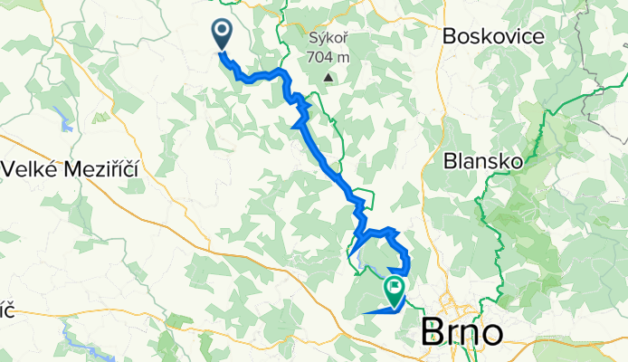
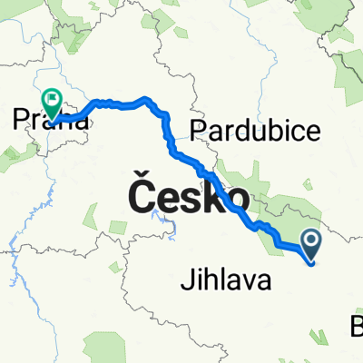
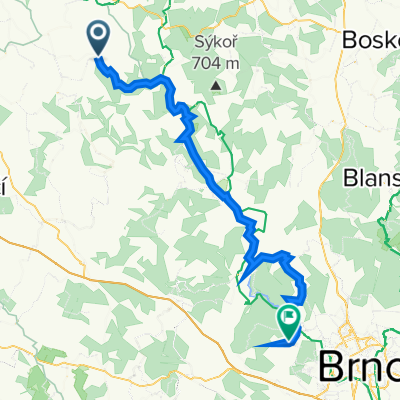
2020_05 Rožná - Bystrc
A cycling route starting in Bystřice nad Pernštejnem, Kraj Vysočina, Czechia.
Overview
About this route
17: 5. 2020 s Věrou
- -:--
- Duration
- 56.7 km
- Distance
- 1,469 m
- Ascent
- 1,684 m
- Descent
- ---
- Avg. speed
- 516 m
- Max. altitude

Route quality
Waytypes & surfaces along the route
Waytypes
Road
18.7 km
(33 %)
Quiet road
10.8 km
(19 %)
Surfaces
Paved
40.8 km
(72 %)
Unpaved
5.7 km
(10 %)
Asphalt
37.4 km
(66 %)
Paved (undefined)
2.8 km
(5 %)
Route highlights
Points of interest along the route
Point of interest after 19.5 km
Skryti pod lípou před deštěm
Point of interest after 27 km
Restaurace Na Humpolce
Point of interest after 50.1 km
Osada
Point of interest after 54 km
U kosa
Continue with Bikemap
Use, edit, or download this cycling route
You would like to ride 2020_05 Rožná - Bystrc or customize it for your own trip? Here is what you can do with this Bikemap route:
Free features
- Save this route as favorite or in collections
- Copy & plan your own version of this route
- Sync your route with Garmin or Wahoo
Premium features
Free trial for 3 days, or one-time payment. More about Bikemap Premium.
- Navigate this route on iOS & Android
- Export a GPX / KML file of this route
- Create your custom printout (try it for free)
- Download this route for offline navigation
Discover more Premium features.
Get Bikemap PremiumFrom our community
Other popular routes starting in Bystřice nad Pernštejnem
 Borovinka 2.den
- Distance
- 53.8 km
- Ascent
- 597 m
- Descent
- 597 m
- Location
- Bystřice nad Pernštejnem, Kraj Vysočina, Czechia
 Vír - Chlum - Rovečné - Malé Tresné - Vír (pěšky)
- Distance
- 15.2 km
- Ascent
- 447 m
- Descent
- 448 m
- Location
- Bystřice nad Pernštejnem, Kraj Vysočina, Czechia
 Adrex-E1-Vír-Karasín-Štarkov-Bohdalec
- Distance
- 52.7 km
- Ascent
- 1,188 m
- Descent
- 1,187 m
- Location
- Bystřice nad Pernštejnem, Kraj Vysočina, Czechia
 Bystrice nad Pernstejnem okruh - 38 km
- Distance
- 37.9 km
- Ascent
- 556 m
- Descent
- 556 m
- Location
- Bystřice nad Pernštejnem, Kraj Vysočina, Czechia
 2 nap van hátra
- Distance
- 198.5 km
- Ascent
- 1,380 m
- Descent
- 1,646 m
- Location
- Bystřice nad Pernštejnem, Kraj Vysočina, Czechia
 2020_05 Rožná - Bystrc
- Distance
- 56.7 km
- Ascent
- 1,469 m
- Descent
- 1,684 m
- Location
- Bystřice nad Pernštejnem, Kraj Vysočina, Czechia
 Borovinka 4.den
- Distance
- 36 km
- Ascent
- 617 m
- Descent
- 616 m
- Location
- Bystřice nad Pernštejnem, Kraj Vysočina, Czechia
 BnP - Vír - Dalečín - BnP
- Distance
- 30.1 km
- Ascent
- 0 m
- Descent
- 0 m
- Location
- Bystřice nad Pernštejnem, Kraj Vysočina, Czechia
Open it in the app