

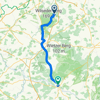
Geländefahrt zum Mittagsschlaf
A cycling route starting in Hanstedt, Lower Saxony, Germany.
Overview
About this route
Suitable for towing
- -:--
- Duration
- 21.1 km
- Distance
- 224 m
- Ascent
- 196 m
- Descent
- ---
- Avg. speed
- ---
- Max. altitude

Route quality
Waytypes & surfaces along the route
Waytypes
Track
8.7 km
(41 %)
Path
5.9 km
(28 %)
Surfaces
Paved
13.5 km
(64 %)
Unpaved
6.8 km
(32 %)
Asphalt
9.9 km
(47 %)
Gravel
4.4 km
(21 %)
Continue with Bikemap
Use, edit, or download this cycling route
You would like to ride Geländefahrt zum Mittagsschlaf or customize it for your own trip? Here is what you can do with this Bikemap route:
Free features
- Save this route as favorite or in collections
- Copy & plan your own version of this route
- Sync your route with Garmin or Wahoo
Premium features
Free trial for 3 days, or one-time payment. More about Bikemap Premium.
- Navigate this route on iOS & Android
- Export a GPX / KML file of this route
- Create your custom printout (try it for free)
- Download this route for offline navigation
Discover more Premium features.
Get Bikemap PremiumFrom our community
Other popular routes starting in Hanstedt
 kl. Heiderunde
- Distance
- 34.4 km
- Ascent
- 246 m
- Descent
- 246 m
- Location
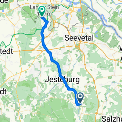
- Hanstedt, Lower Saxony, Germany
 Geländefahrt zum Mittagsschlaf
- Distance
- 21.1 km
- Ascent
- 224 m
- Descent
- 196 m
- Location
- Hanstedt, Lower Saxony, Germany
 Hanstedt - Celle
- Distance
- 87.1 km
- Ascent
- 458 m
- Descent
- 465 m
- Location
- Hanstedt, Lower Saxony, Germany
 Uelzen - Winsen
- Distance
- 27.2 km
- Ascent
- 216 m
- Descent
- 180 m
- Location
- Hanstedt, Lower Saxony, Germany
 mit Anki los
- Distance
- 37.2 km
- Ascent
- 496 m
- Descent
- 495 m
- Location
- Hanstedt, Lower Saxony, Germany
 Nindorf - Seeve - Sprötze
- Distance
- 23.5 km
- Ascent
- 122 m
- Descent
- 123 m
- Location
- Hanstedt, Lower Saxony, Germany
 Waldbad Runde
- Distance
- 38 km
- Ascent
- 590 m
- Descent
- 590 m
- Location
- Hanstedt, Lower Saxony, Germany
 abwechslungsreiche MTB-Route mit Singletrail
- Distance
- 23 km
- Ascent
- 949 m
- Descent
- 970 m
- Location
- Hanstedt, Lower Saxony, Germany
Open it in the app