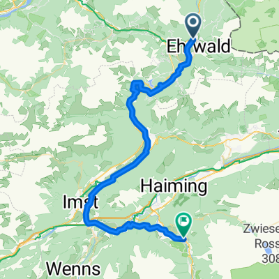
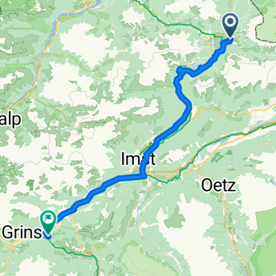
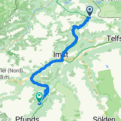
Zugspitztour Tag 2
A cycling route starting in Ehrwald, Tyrol, Austria.
Overview
About this route
- -:--
- Duration
- 49.7 km
- Distance
- 378 m
- Ascent
- 1,175 m
- Descent
- ---
- Avg. speed
- ---
- Max. altitude
Continue with Bikemap
Use, edit, or download this cycling route
You would like to ride Zugspitztour Tag 2 or customize it for your own trip? Here is what you can do with this Bikemap route:
Free features
- Save this route as favorite or in collections
- Copy & plan your own version of this route
- Sync your route with Garmin or Wahoo
Premium features
Free trial for 3 days, or one-time payment. More about Bikemap Premium.
- Navigate this route on iOS & Android
- Export a GPX / KML file of this route
- Create your custom printout (try it for free)
- Download this route for offline navigation
Discover more Premium features.
Get Bikemap PremiumFrom our community
Other popular routes starting in Ehrwald
Biberwier - Landeck- Distance
- 53.3 km
- Ascent
- 1,124 m
- Descent
- 1,328 m
- Location
- Ehrwald, Tyrol, Austria
Marienberg Alm– Grubigtrail- Distance
- 52.8 km
- Ascent
- 2,028 m
- Descent
- 2,030 m
- Location
- Ehrwald, Tyrol, Austria
Augusta 3- Distance
- 58.6 km
- Ascent
- 1,237 m
- Descent
- 1,461 m
- Location
- Ehrwald, Tyrol, Austria
Tag 3: Über den Fernpass- Distance
- 74.7 km
- Ascent
- 794 m
- Descent
- 935 m
- Location
- Ehrwald, Tyrol, Austria
Hahntennjoch- Distance
- 105.1 km
- Ascent
- 1,948 m
- Descent
- 1,950 m
- Location
- Ehrwald, Tyrol, Austria
Ehrwald - Serfaus- Distance
- 72.2 km
- Ascent
- 1,686 m
- Descent
- 1,772 m
- Location
- Ehrwald, Tyrol, Austria
Rund um die Zugspitze- Distance
- 79.8 km
- Ascent
- 1,168 m
- Descent
- 1,168 m
- Location
- Ehrwald, Tyrol, Austria
Rund um den Wannig- Distance
- 38.8 km
- Ascent
- 932 m
- Descent
- 1,080 m
- Location
- Ehrwald, Tyrol, Austria
Open it in the app


