

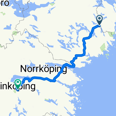
Flen till Bergs Gård: Gårdscafé & butik, Mountainbike, Boende och Relax
A cycling route starting in Gnesta, Södermanland County, Sweden.
Overview
About this route
- -:--
- Duration
- 25.9 km
- Distance
- 200 m
- Ascent
- 224 m
- Descent
- ---
- Avg. speed
- ---
- Max. altitude
Route quality
Waytypes & surfaces along the route
Waytypes
Road
8.3 km
(32 %)
Quiet road
4.1 km
(16 %)
Surfaces
Paved
17.9 km
(69 %)
Unpaved
4.4 km
(17 %)
Asphalt
16.3 km
(63 %)
Gravel
4.4 km
(17 %)
Route highlights
Points of interest along the route
Accommodation after 0 km
Södertuna Slott/Castle
Accommodation after 0.1 km
Skyttåsa Bed & Breakfast (Nära naturen / Close to Nature)
Drinking water after 0.1 km
Björnlunda Resto (Restaurant & Mini Golf, Husmanskost/Swedish Food)
Point of interest after 0.1 km
Sterners Choklad/Chocolate Shop
Drinking water after 0.1 km
ICA Jarbells varuhus (Grocery Store)
Point of interest after 0.1 km
Mäster Claes (Prisad Trädgård/Beloved Gardens)
Point of interest after 0.1 km
Skeppsta Hytta Glasblåseri/Glass Blower's Shop
Accommodation after 0.1 km
Dancenter Deutsche Ferienhaus
Accommodation after 0.1 km
Grytsberg Säteri/Manor (med 1600-talsbyggnader / with buildings from the 1600's)
Point of interest after 3.4 km
Vårdinge Kyrka / Church
Point of interest after 11.4 km
Torsåker Kyrka / Church
Drinking water after 16.2 km
Sund Nergården, Restaurant & B&B
Point of interest after 17.7 km
Sillebadet / Sille Beach
Point of interest after 18.8 km
Västerljungs Blommor / Flower Garden
Point of interest after 20.4 km
Vagnhärad Tätort / Town
Point of interest after 20.4 km
Västerljungs Kyrka / Church
Continue with Bikemap
Use, edit, or download this cycling route
You would like to ride Flen till Bergs Gård: Gårdscafé & butik, Mountainbike, Boende och Relax or customize it for your own trip? Here is what you can do with this Bikemap route:
Free features
- Save this route as favorite or in collections
- Copy & plan your own version of this route
- Sync your route with Garmin or Wahoo
Premium features
Free trial for 3 days, or one-time payment. More about Bikemap Premium.
- Navigate this route on iOS & Android
- Export a GPX / KML file of this route
- Create your custom printout (try it for free)
- Download this route for offline navigation
Discover more Premium features.
Get Bikemap PremiumFrom our community
Other popular routes starting in Gnesta
 Förslag 2 Gnestaalternativet
- Distance
- 168.3 km
- Ascent
- 371 m
- Descent
- 370 m
- Location
- Gnesta, Södermanland County, Sweden
 Mälby-Laxne (canoeing)
- Distance
- 27 km
- Ascent
- 209 m
- Descent
- 204 m
- Location
- Gnesta, Södermanland County, Sweden
 gasinge/vangharad/gasinge
- Distance
- 56.6 km
- Ascent
- 953 m
- Descent
- 949 m
- Location
- Gnesta, Södermanland County, Sweden
 Södertuna - Sund
- Distance
- 31.2 km
- Ascent
- 400 m
- Descent
- 394 m
- Location
- Gnesta, Södermanland County, Sweden
 Södertuna to Laxne (working)
- Distance
- 18.8 km
- Ascent
- 189 m
- Descent
- 175 m
- Location
- Gnesta, Södermanland County, Sweden
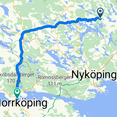 Gnesta - Norrköping
- Distance
- 102.1 km
- Ascent
- 68 m
- Descent
- 70 m
- Location
- Gnesta, Södermanland County, Sweden
 Gnesta väst - Storsjön runt
- Distance
- 42.2 km
- Ascent
- 253 m
- Descent
- 254 m
- Location
- Gnesta, Södermanland County, Sweden
 Hem-Gnesta-Göta kanal
- Distance
- 184.5 km
- Ascent
- 1,471 m
- Descent
- 1,428 m
- Location
- Gnesta, Södermanland County, Sweden
Open it in the app