

Gepflastertes Ackerland - Nordschleife
A cycling route starting in Ismaning, Bavaria, Germany.
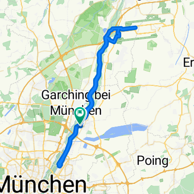
Overview
About this route
Fits well with the South Loop.
- -:--
- Duration
- 23.5 km
- Distance
- 32 m
- Ascent
- 32 m
- Descent
- ---
- Avg. speed
- ---
- Max. altitude

Route quality
Waytypes & surfaces along the route
Waytypes
Path
10.6 km
(45 %)
Quiet road
8.7 km
(37 %)
Surfaces
Paved
21.8 km
(93 %)
Unpaved
1.6 km
(7 %)
Asphalt
21.8 km
(93 %)
Gravel
1.6 km
(7 %)
Continue with Bikemap
Use, edit, or download this cycling route
You would like to ride Gepflastertes Ackerland - Nordschleife or customize it for your own trip? Here is what you can do with this Bikemap route:
Free features
- Save this route as favorite or in collections
- Copy & plan your own version of this route
- Sync your route with Garmin or Wahoo
Premium features
Free trial for 3 days, or one-time payment. More about Bikemap Premium.
- Navigate this route on iOS & Android
- Export a GPX / KML file of this route
- Create your custom printout (try it for free)
- Download this route for offline navigation
Discover more Premium features.
Get Bikemap PremiumFrom our community
Other popular routes starting in Ismaning
 Ismaning - Seefeld
- Distance
- 144.6 km
- Ascent
- 884 m
- Descent
- 130 m
- Location
- Ismaning, Bavaria, Germany
 Ismaning-Erding
- Distance
- 66.8 km
- Ascent
- 109 m
- Descent
- 110 m
- Location
- Ismaning, Bavaria, Germany
 Isar-Radweg Teil 2
- Distance
- 146.6 km
- Ascent
- 594 m
- Descent
- 745 m
- Location
- Ismaning, Bavaria, Germany
 Ismaning-Markt Schwaben lang
- Distance
- 54.4 km
- Ascent
- 105 m
- Descent
- 104 m
- Location
- Ismaning, Bavaria, Germany
 Ismaning-Freising
- Distance
- 70.3 km
- Ascent
- 125 m
- Descent
- 124 m
- Location
- Ismaning, Bavaria, Germany
 Ismaning - Neufinsing - Markt Schwaben - Niederneuching - Ismaning
- Distance
- 43.5 km
- Ascent
- 82 m
- Descent
- 80 m
- Location
- Ismaning, Bavaria, Germany
 Ismaning - MUC Flughafen - Isar
- Distance
- 57.2 km
- Ascent
- 72 m
- Descent
- 80 m
- Location
- Ismaning, Bavaria, Germany
 Von Ismaning zum Aumeister
- Distance
- 31 km
- Ascent
- 56 m
- Descent
- 70 m
- Location
- Ismaning, Bavaria, Germany
Open it in the app