

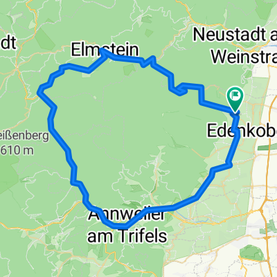
St. Martin - Rundweg über Rhodt - Burrweiler - Edenkoben
A cycling route starting in Sankt Martin, Rhineland-Palatinate, Germany.
Overview
About this route
Radrundweg ab St. Martin durch die Weindörfer Rhodt-Hainfeld-Burrweiler-Flemlingen-Roschbach-Edesheim- Edenkoben
- -:--
- Duration
- 23 km
- Distance
- 229 m
- Ascent
- 227 m
- Descent
- ---
- Avg. speed
- ---
- Avg. speed

Route quality
Waytypes & surfaces along the route
Waytypes
Track
8.6 km
(37 %)
Quiet road
6 km
(26 %)
Surfaces
Paved
19.8 km
(86 %)
Unpaved
1.3 km
(6 %)
Asphalt
15.5 km
(67 %)
Paving stones
1.7 km
(7 %)
Continue with Bikemap
Use, edit, or download this cycling route
You would like to ride St. Martin - Rundweg über Rhodt - Burrweiler - Edenkoben or customize it for your own trip? Here is what you can do with this Bikemap route:
Free features
- Save this route as favorite or in collections
- Copy & plan your own version of this route
- Sync your route with Garmin or Wahoo
Premium features
Free trial for 3 days, or one-time payment. More about Bikemap Premium.
- Navigate this route on iOS & Android
- Export a GPX / KML file of this route
- Create your custom printout (try it for free)
- Download this route for offline navigation
Discover more Premium features.
Get Bikemap PremiumFrom our community
Other popular routes starting in Sankt Martin
 Einmal um den Kalmit
- Distance
- 12.4 km
- Ascent
- 392 m
- Descent
- 392 m
- Location
- Sankt Martin, Rhineland-Palatinate, Germany
 05-MRZ-11
- Distance
- 13.5 km
- Ascent
- 561 m
- Descent
- 560 m
- Location
- Sankt Martin, Rhineland-Palatinate, Germany
 Über Anweiler nach Steinborn
- Distance
- 80.5 km
- Ascent
- 696 m
- Descent
- 712 m
- Location
- Sankt Martin, Rhineland-Palatinate, Germany
 9.10.2019
- Distance
- 11.2 km
- Ascent
- 321 m
- Descent
- 273 m
- Location
- Sankt Martin, Rhineland-Palatinate, Germany
 Edenkobener Radpfad durch Forst bis Römische Wachstube von Hawai
- Distance
- 15.3 km
- Ascent
- 284 m
- Descent
- 453 m
- Location
- Sankt Martin, Rhineland-Palatinate, Germany
 Hausrunde
- Distance
- 21.5 km
- Ascent
- 868 m
- Descent
- 868 m
- Location
- Sankt Martin, Rhineland-Palatinate, Germany
 St Martin Ritt durch die Pfalz
- Distance
- 69 km
- Ascent
- 830 m
- Descent
- 834 m
- Location
- Sankt Martin, Rhineland-Palatinate, Germany
 Einfache Fahrt Totenkopfhütte
- Distance
- 2.8 km
- Ascent
- 76 m
- Descent
- 107 m
- Location
- Sankt Martin, Rhineland-Palatinate, Germany
Open it in the app