
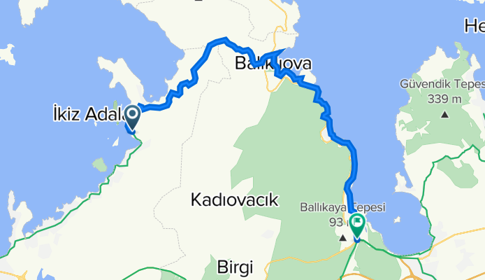
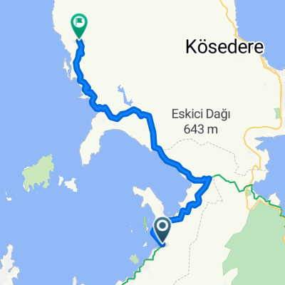
İZMİR | Ildırı (Erythrai) - Balıklıova - Gülbahçe
A cycling route starting in Uzunkuyu, İzmir Province, Republic of Türkiye.
Overview
About this route
- -:--
- Duration
- 33 km
- Distance
- 276 m
- Ascent
- 275 m
- Descent
- ---
- Avg. speed
- ---
- Max. altitude

Continue with Bikemap
Use, edit, or download this cycling route
You would like to ride İZMİR | Ildırı (Erythrai) - Balıklıova - Gülbahçe or customize it for your own trip? Here is what you can do with this Bikemap route:
Free features
- Save this route as favorite or in collections
- Copy & plan your own version of this route
- Sync your route with Garmin or Wahoo
Premium features
Free trial for 3 days, or one-time payment. More about Bikemap Premium.
- Navigate this route on iOS & Android
- Export a GPX / KML file of this route
- Create your custom printout (try it for free)
- Download this route for offline navigation
Discover more Premium features.
Get Bikemap PremiumFrom our community
Other popular routes starting in Uzunkuyu
 uzunkuyu.coast
- Distance
- 23.6 km
- Ascent
- 344 m
- Descent
- 504 m
- Location
- Uzunkuyu, İzmir Province, Republic of Türkiye
 ildir-kucukbahce
- Distance
- 38.3 km
- Ascent
- 0 m
- Descent
- 0 m
- Location
- Uzunkuyu, İzmir Province, Republic of Türkiye
 back to hotel
- Distance
- 17.6 km
- Ascent
- 171 m
- Descent
- 153 m
- Location
- Uzunkuyu, İzmir Province, Republic of Türkiye
 4. gün ıldır-gülbahçe
- Distance
- 22.1 km
- Ascent
- 0 m
- Descent
- 0 m
- Location
- Uzunkuyu, İzmir Province, Republic of Türkiye
 ildir-kucukbahce
- Distance
- 38.3 km
- Ascent
- 741 m
- Descent
- 547 m
- Location
- Uzunkuyu, İzmir Province, Republic of Türkiye
 ildir-kucukbahce
- Distance
- 38.3 km
- Ascent
- 0 m
- Descent
- 0 m
- Location
- Uzunkuyu, İzmir Province, Republic of Türkiye
 karaburun
- Distance
- 118.8 km
- Ascent
- 1,210 m
- Descent
- 1,198 m
- Location
- Uzunkuyu, İzmir Province, Republic of Türkiye
 27000. Sk., Cesme to 3431. Sk. 1, Cesme
- Distance
- 18.6 km
- Ascent
- 133 m
- Descent
- 119 m
- Location
- Uzunkuyu, İzmir Province, Republic of Türkiye
Open it in the app