

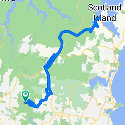
Oxford Falls 25 July 2010
A cycling route starting in Davidson, New South Wales, Australia.
Overview
About this route
- -:--
- Duration
- 32.8 km
- Distance
- 520 m
- Ascent
- 520 m
- Descent
- ---
- Avg. speed
- ---
- Max. altitude
Continue with Bikemap
Use, edit, or download this cycling route
You would like to ride Oxford Falls 25 July 2010 or customize it for your own trip? Here is what you can do with this Bikemap route:
Free features
- Save this route as favorite or in collections
- Copy & plan your own version of this route
- Sync your route with Garmin or Wahoo
Premium features
Free trial for 3 days, or one-time payment. More about Bikemap Premium.
- Navigate this route on iOS & Android
- Export a GPX / KML file of this route
- Create your custom printout (try it for free)
- Download this route for offline navigation
Discover more Premium features.
Get Bikemap PremiumFrom our community
Other popular routes starting in Davidson
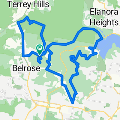
 Mathews St, Davidson to Mathews St, Davidson
- Distance
- 42.1 km
- Ascent
- 672 m
- Descent
- 683 m
- Location
- Davidson, New South Wales, Australia
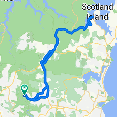
 Oxford Falls 25 July 2010
- Distance
- 32.8 km
- Ascent
- 520 m
- Descent
- 520 m
- Location
- Davidson, New South Wales, Australia
 Mathews St, Davidson to Mathews St, Davidson
- Distance
- 42.1 km
- Ascent
- 661 m
- Descent
- 657 m
- Location
- Davidson, New South Wales, Australia
 OTWS 2015 Section 6
- Distance
- 11.9 km
- Ascent
- 172 m
- Descent
- 307 m
- Location
- Davidson, New South Wales, Australia
 Garigal - Cascades 2
- Distance
- 17.2 km
- Ascent
- 394 m
- Descent
- 394 m
- Location
- Davidson, New South Wales, Australia
 St Ives Loop March 2
- Distance
- 18.3 km
- Ascent
- 407 m
- Descent
- 407 m
- Location
- Davidson, New South Wales, Australia
 Bobbin Head
- Distance
- 32.1 km
- Ascent
- 769 m
- Descent
- 769 m
- Location
- Davidson, New South Wales, Australia
 Belrose to Deep Creek
- Distance
- 6.5 km
- Ascent
- 98 m
- Descent
- 227 m
- Location
- Davidson, New South Wales, Australia
Open it in the app