

Radweg Thüringer Städtekette: Altenburg - Gera
A cycling route starting in Altenburg, Free State of Thuringia, Germany.
Overview
About this route
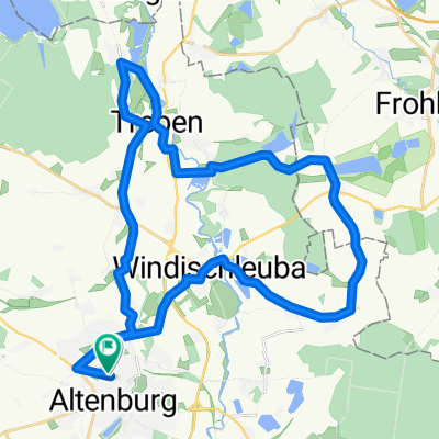
Radweg Thüringer Städtekette
Etappe: Altenburg - Gera
Ausgeschilderte Radtour durch das kulturell und landschaftlich reizvolle Thüringen entlang der Thüringer Städte von Altenburg im Osten bis Eisenach im Westen.
Der Radfernweg „Thüringer Städtekette“ verbindet sieben der schönsten Thüringer Städte und führt ebenso durch landschaftlich reizvolle Gegenden Thüringens, die durch ihre reiche Geschichte geprägt sind. Dieser Radfernweg ist besonders für Kulturinteressierte und Tourenradler geeignet. Auf ca. 240 km quer durch Thüringen bieten sich immer wieder historische Innenstädte, bekannte Sehenswürdigkeiten und kulturelle Highlights als Etappenziele an. Alle Städte entlang des Radfernweges – Altenburg, Gera, Jena, Weimar, Erfurt, Gotha, Eisenach – sind an das Streckennetz der Deutschen Bahn angeschlossen, somit können auch Teilabschnitte des Radweges unkompliziert abgefahren werden.
Derzeitige Beschaffenheit: Asphalt - 194 km. Pflasterstraße - 6 km. Schotter - 40 km (Stand Anfang 2009).
Weitere Etappen auf bikemap.net:
Gera - Jena
Jena - Weimar
Weimar - Erfurt
Erfurt - Gotha
Gotha - Eisenach
- -:--
- Duration
- 44.9 km
- Distance
- 225 m
- Ascent
- 209 m
- Descent
- ---
- Avg. speed
- ---
- Max. altitude
Route quality
Waytypes & surfaces along the route
Waytypes
Quiet road
11.1 km
(25 %)
Track
7.8 km
(17 %)
Surfaces
Paved
33.2 km
(74 %)
Unpaved
3.1 km
(7 %)
Asphalt
30 km
(67 %)
Gravel
3.1 km
(7 %)
Continue with Bikemap
Use, edit, or download this cycling route
You would like to ride Radweg Thüringer Städtekette: Altenburg - Gera or customize it for your own trip? Here is what you can do with this Bikemap route:
Free features
- Save this route as favorite or in collections
- Copy & plan your own version of this route
- Sync your route with Garmin or Wahoo
Premium features
Free trial for 3 days, or one-time payment. More about Bikemap Premium.
- Navigate this route on iOS & Android
- Export a GPX / KML file of this route
- Create your custom printout (try it for free)
- Download this route for offline navigation
Discover more Premium features.
Get Bikemap PremiumFrom our community
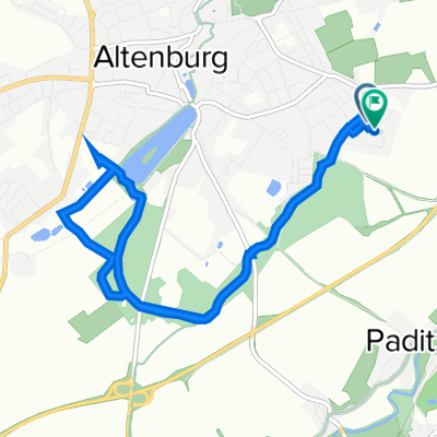
Other popular routes starting in Altenburg
 Schloßberg 1B, Altenburg nach Wenzelstraße 43, Altenburg
- Distance
- 63.8 km
- Ascent
- 685 m
- Descent
- 768 m
- Location
- Altenburg, Free State of Thuringia, Germany
 Wenzelstraße 43, Altenburg nach Wenzelstraße 43, Altenburg
- Distance
- 44.5 km
- Ascent
- 248 m
- Descent
- 298 m
- Location
- Altenburg, Free State of Thuringia, Germany
 Grosse Seen Rundfahrt um Altenburg
- Distance
- 75.1 km
- Ascent
- 276 m
- Descent
- 276 m
- Location
- Altenburg, Free State of Thuringia, Germany
 NightTrail ABG
- Distance
- 19 km
- Ascent
- 226 m
- Descent
- 226 m
- Location
- Altenburg, Free State of Thuringia, Germany
 2 RSG2019
- Distance
- 126.4 km
- Ascent
- 1,019 m
- Descent
- 698 m
- Location
- Altenburg, Free State of Thuringia, Germany
 Franz-Mehring-Straße 20, Altenburg nach Franz-Mehring-Straße 28, Altenburg
- Distance
- 34.9 km
- Ascent
- 177 m
- Descent
- 216 m
- Location
- Altenburg, Free State of Thuringia, Germany
 Altenburg Polsterstein
- Distance
- 59 km
- Ascent
- 401 m
- Descent
- 442 m
- Location
- Altenburg, Free State of Thuringia, Germany
 Altenburg Südost - Sternengarten - Märchenbrunnen - zurück
- Distance
- 8.2 km
- Ascent
- 114 m
- Descent
- 112 m
- Location
- Altenburg, Free State of Thuringia, Germany
Open it in the app