

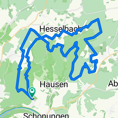
Main-steigerwald-Main
A cycling route starting in Schonungen, Bavaria, Germany.
Overview
About this route
Road cycling tour from the Main to the Steigerwald Höhenstraße
- -:--
- Duration
- 75.2 km
- Distance
- 438 m
- Ascent
- 413 m
- Descent
- ---
- Avg. speed
- 323 m
- Max. altitude
Route quality
Waytypes & surfaces along the route
Waytypes
Road
32.3 km
(43 %)
Path
15 km
(20 %)
Surfaces
Paved
57.9 km
(77 %)
Unpaved
1.5 km
(2 %)
Asphalt
57.1 km
(76 %)
Paved (undefined)
0.8 km
(1 %)
Continue with Bikemap
Use, edit, or download this cycling route
You would like to ride Main-steigerwald-Main or customize it for your own trip? Here is what you can do with this Bikemap route:
Free features
- Save this route as favorite or in collections
- Copy & plan your own version of this route
- Sync your route with Garmin or Wahoo
Premium features
Free trial for 3 days, or one-time payment. More about Bikemap Premium.
- Navigate this route on iOS & Android
- Export a GPX / KML file of this route
- Create your custom printout (try it for free)
- Download this route for offline navigation
Discover more Premium features.
Get Bikemap PremiumFrom our community
Other popular routes starting in Schonungen
 Schonungen sennfeld
- Distance
- 11.1 km
- Ascent
- 42 m
- Descent
- 33 m
- Location
- Schonungen, Bavaria, Germany
 Schonungen - Werneck
- Distance
- 18.8 km
- Ascent
- 53 m
- Descent
- 45 m
- Location
- Schonungen, Bavaria, Germany
 Reichmannshäuser Straße 7, Schonungen nach Kirchstraße 1, Werneck
- Distance
- 31.9 km
- Ascent
- 195 m
- Descent
- 322 m
- Location
- Schonungen, Bavaria, Germany
 Grundstraße 14, Schonungen nach Bahnhofstraße 9, Prichsenstadt
- Distance
- 54.9 km
- Ascent
- 468 m
- Descent
- 443 m
- Location
- Schonungen, Bavaria, Germany
 Schweinfurt
- Distance
- 36.7 km
- Ascent
- 494 m
- Descent
- 485 m
- Location
- Schonungen, Bavaria, Germany
 Ausfahrt von Schonungen nach Volkach
- Distance
- 29.9 km
- Ascent
- 49 m
- Descent
- 61 m
- Location
- Schonungen, Bavaria, Germany
 Main-steigerwald-Main
- Distance
- 75.2 km
- Ascent
- 438 m
- Descent
- 413 m
- Location
- Schonungen, Bavaria, Germany
 Hegmühlweg 5, Schonungen nach Hegholz 9, Schonungen
- Distance
- 13.3 km
- Ascent
- 83 m
- Descent
- 82 m
- Location
- Schonungen, Bavaria, Germany
Open it in the app