

Etappe 13 Tour de France 2009 von Vittel nach Colmar CLONED FROM ROUTE 95265
A cycling route starting in Vittel, Grand Est, France.
Overview
About this route
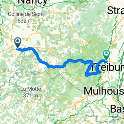
Tour de France 2009Stage 13 from July 17, 2009from Vittel to Colmar
Medium mountain stage with 200 km in length
to the 12th stage 2009 / to the 14th stage 2009Le Tour / Stage 13 - The Original
Climbs and gradients for the stage:
- Km 46.0 - Côte de Xertigny 2.0 km at 5.3 % - Km 105.0 - Col de la Schlucht 8.9 km at 4.1 %- Km 138.5 - Col du Platzerwasel 8.7 km at 7.6 % - Km 165.5 - Col du Bannstein 2.1 km at 5.1 % - Km 179.5 - Col du Firstplan 8.4 km at 5.4 %
- -:--
- Duration
- 205.1 km
- Distance
- 2,515 m
- Ascent
- 2,663 m
- Descent
- ---
- Avg. speed
- ---
- Max. altitude

Route quality
Waytypes & surfaces along the route
Waytypes
Road
22.6 km
(11 %)
Track
20.5 km
(10 %)
Surfaces
Paved
96.4 km
(47 %)
Unpaved
8.2 km
(4 %)
Asphalt
94.3 km
(46 %)
Gravel
4.1 km
(2 %)
Continue with Bikemap
Use, edit, or download this cycling route
You would like to ride Etappe 13 Tour de France 2009 von Vittel nach Colmar CLONED FROM ROUTE 95265 or customize it for your own trip? Here is what you can do with this Bikemap route:
Free features
- Save this route as favorite or in collections
- Copy & plan your own version of this route
- Split it into stages to create a multi-day tour
- Sync your route with Garmin or Wahoo
Premium features
Free trial for 3 days, or one-time payment. More about Bikemap Premium.
- Navigate this route on iOS & Android
- Export a GPX / KML file of this route
- Create your custom printout (try it for free)
- Download this route for offline navigation
Discover more Premium features.
Get Bikemap PremiumFrom our community
Other popular routes starting in Vittel
 Tour de France 2009, Etappe 13 - 200,0 km
- Distance
- 201.6 km
- Ascent
- 2,812 m
- Descent
- 2,530 m
- Location
- Vittel, Grand Est, France
 Etappe 13 Tour de France 2009 von Vittel nach Colmar CLONED FROM ROUTE 95265
- Distance
- 205.1 km
- Ascent
- 2,515 m
- Descent
- 2,663 m
- Location
- Vittel, Grand Est, France
 10) Vittel - Grand Ballon
- Distance
- 164.7 km
- Ascent
- 2,605 m
- Descent
- 1,593 m
- Location
- Vittel, Grand Est, France
 VITTEL
- Distance
- 30.8 km
- Ascent
- 405 m
- Descent
- 395 m
- Location
- Vittel, Grand Est, France
 De 424 Rue de Lignéville, Vittel à 10 Rue Sainte-Anne, Bulgnéville
- Distance
- 11.9 km
- Ascent
- 135 m
- Descent
- 143 m
- Location
- Vittel, Grand Est, France
 Stage 5 » Vittel › La Planche des Belles Filles (160k)
- Distance
- 160.2 km
- Ascent
- 1,665 m
- Descent
- 869 m
- Location
- Vittel, Grand Est, France
 Roundtrip Vittel
- Distance
- 46.4 km
- Ascent
- 579 m
- Descent
- 579 m
- Location
- Vittel, Grand Est, France
 VITTEL - LA PLANCHE DES BELLES FILLES
- Distance
- 159.4 km
- Ascent
- 1,703 m
- Descent
- 1,023 m
- Location
- Vittel, Grand Est, France
Open it in the app