

KEV Kölnpfad Etappe 10 Stand 201612
A cycling route starting in Wahn-Heide, North Rhine-Westphalia, Germany.
Overview
About this route
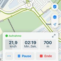
- -:--
- Duration
- 18.9 km
- Distance
- 63 m
- Ascent
- 67 m
- Descent
- ---
- Avg. speed
- ---
- Max. altitude

Route quality
Waytypes & surfaces along the route
Waytypes
Track
9.5 km
(50 %)
Path
6.8 km
(36 %)
Surfaces
Paved
13.6 km
(72 %)
Unpaved
3.2 km
(17 %)
Asphalt
12.9 km
(68 %)
Ground
1.3 km
(7 %)
Continue with Bikemap
Use, edit, or download this cycling route
You would like to ride KEV Kölnpfad Etappe 10 Stand 201612 or customize it for your own trip? Here is what you can do with this Bikemap route:
Free features
- Save this route as favorite or in collections
- Copy & plan your own version of this route
- Sync your route with Garmin or Wahoo
Premium features
Free trial for 3 days, or one-time payment. More about Bikemap Premium.
- Navigate this route on iOS & Android
- Export a GPX / KML file of this route
- Create your custom printout (try it for free)
- Download this route for offline navigation
Discover more Premium features.
Get Bikemap PremiumFrom our community
Other popular routes starting in Wahn-Heide
 Jakobsweg
- Distance
- 2,145.4 km
- Ascent
- 3,411 m
- Descent
- 3,218 m
- Location
- Wahn-Heide, North Rhine-Westphalia, Germany
 Spich-Holzlar.gpx
- Distance
- 15.7 km
- Ascent
- 61 m
- Descent
- 24 m
- Location
- Wahn-Heide, North Rhine-Westphalia, Germany
 CYCLING THE RHINE: Route Approach F
- Distance
- 16.8 km
- Ascent
- 93 m
- Descent
- 104 m
- Location
- Wahn-Heide, North Rhine-Westphalia, Germany
 Liburer Landstraße, Köln nach Dahlienweg, Köln
- Distance
- 4.4 km
- Ascent
- 3 m
- Descent
- 10 m
- Location
- Wahn-Heide, North Rhine-Westphalia, Germany
 Flughafen Köln/Bonn - Waldbröl
- Distance
- 49.6 km
- Ascent
- 508 m
- Descent
- 236 m
- Location
- Wahn-Heide, North Rhine-Westphalia, Germany
 RTC Köln RTF 2008 150 Km
- Distance
- 141.4 km
- Ascent
- 1,030 m
- Descent
- 1,036 m
- Location
- Wahn-Heide, North Rhine-Westphalia, Germany
 Rath-Heumar,Bensberg,Forsbach
- Distance
- 32 km
- Ascent
- 150 m
- Descent
- 150 m
- Location
- Wahn-Heide, North Rhine-Westphalia, Germany
 Flughafen
- Distance
- 26.2 km
- Ascent
- 663 m
- Descent
- 638 m
- Location
- Wahn-Heide, North Rhine-Westphalia, Germany
Open it in the app