

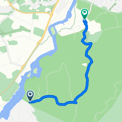
Hjälmaren runt
A cycling route starting in Skogstorp, Södermanland County, Sweden.
Overview
About this route
Planning for Ascension Day 2020
- -:--
- Duration
- 192.9 km
- Distance
- 341 m
- Ascent
- 340 m
- Descent
- ---
- Avg. speed
- ---
- Max. altitude

Route quality
Waytypes & surfaces along the route
Waytypes
Quiet road
36.6 km
(19 %)
Road
17.4 km
(9 %)
Surfaces
Paved
154.3 km
(80 %)
Unpaved
32.8 km
(17 %)
Asphalt
154.3 km
(80 %)
Unpaved (undefined)
32.8 km
(17 %)
Undefined
5.8 km
(3 %)
Continue with Bikemap
Use, edit, or download this cycling route
You would like to ride Hjälmaren runt or customize it for your own trip? Here is what you can do with this Bikemap route:
Free features
- Save this route as favorite or in collections
- Copy & plan your own version of this route
- Split it into stages to create a multi-day tour
- Sync your route with Garmin or Wahoo
Premium features
Free trial for 3 days, or one-time payment. More about Bikemap Premium.
- Navigate this route on iOS & Android
- Export a GPX / KML file of this route
- Create your custom printout (try it for free)
- Download this route for offline navigation
Discover more Premium features.
Get Bikemap PremiumFrom our community
Other popular routes starting in Skogstorp
 Charlie volvo 859
- Distance
- 4 km
- Ascent
- 23 m
- Descent
- 85 m
- Location
- Skogstorp, Södermanland County, Sweden
 Väg utan namn to Väg utan namn
- Distance
- 10.7 km
- Ascent
- 293 m
- Descent
- 254 m
- Location
- Skogstorp, Södermanland County, Sweden
 Vilsta-Tumbo
- Distance
- 21.7 km
- Ascent
- 421 m
- Descent
- 461 m
- Location
- Skogstorp, Södermanland County, Sweden
 Skogstorp - Tumba
- Distance
- 92.1 km
- Ascent
- 906 m
- Descent
- 920 m
- Location
- Skogstorp, Södermanland County, Sweden
 Löjtnantsvägen 14 to Kolsvagatan 2A
- Distance
- 45.1 km
- Ascent
- 220 m
- Descent
- 229 m
- Location
- Skogstorp, Södermanland County, Sweden
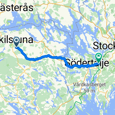
 Eskilstuna, Malmköping, Mariefred, Strängnäs, Eskilstuna
- Distance
- 160.6 km
- Ascent
- 1,370 m
- Descent
- 1,367 m
- Location
- Skogstorp, Södermanland County, Sweden
 Löjtnantsvägen 12 to Kolsvagatan 2A
- Distance
- 44.7 km
- Ascent
- 466 m
- Descent
- 479 m
- Location
- Skogstorp, Södermanland County, Sweden
 Tandlavägen 14 to Ringborregatan 1C
- Distance
- 56.7 km
- Ascent
- 577 m
- Descent
- 583 m
- Location
- Skogstorp, Södermanland County, Sweden
Open it in the app