

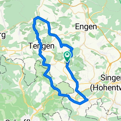
Hilzingen, Wutachtal, Schwarzwaldpanoramastraße, Klettgau, Rhein CLONED FROM ROUTE 111674
A cycling route starting in Hilzingen, Baden-Württemberg, Germany.
Overview
About this route
Etwa 50km längere Variante:
Ab Bonndorf nicht Richtung Stühlingen abfahren sondern weiter Richtung Rothaus und bei Ebnet richtung Wutöschingen abfahren. Über Klettgau weiter Richtung Hohentengen und bei Rüdlingen über die Grenze und dann auf der schweizerischen Rheinseite zum Rheinfall.
Dort hat man die Wahl über den Radweg nach Schaffhausen abzufahren (Autofrei aber bisweilen voller Spaziergänger) oder die reguläre Strasse.
Dann weiter auf der Originalroute.
- -:--
- Duration
- 142.6 km
- Distance
- 1,261 m
- Ascent
- 1,261 m
- Descent
- ---
- Avg. speed
- ---
- Max. altitude
Route quality
Waytypes & surfaces along the route
Waytypes
Busy road
68.9 km
(48 %)
Road
44.1 km
(31 %)
Surfaces
Paved
116.9 km
(82 %)
Unpaved
4.1 km
(3 %)
Asphalt
114.7 km
(80 %)
Gravel
2.9 km
(2 %)
Continue with Bikemap
Use, edit, or download this cycling route
You would like to ride Hilzingen, Wutachtal, Schwarzwaldpanoramastraße, Klettgau, Rhein CLONED FROM ROUTE 111674 or customize it for your own trip? Here is what you can do with this Bikemap route:
Free features
- Save this route as favorite or in collections
- Copy & plan your own version of this route
- Split it into stages to create a multi-day tour
- Sync your route with Garmin or Wahoo
Premium features
Free trial for 3 days, or one-time payment. More about Bikemap Premium.
- Navigate this route on iOS & Android
- Export a GPX / KML file of this route
- Create your custom printout (try it for free)
- Download this route for offline navigation
Discover more Premium features.
Get Bikemap PremiumFrom our community
Other popular routes starting in Hilzingen
 Der heilige Kral
- Distance
- 63.8 km
- Ascent
- 969 m
- Descent
- 969 m
- Location
- Hilzingen, Baden-Württemberg, Germany
 Binningen - Höri - Binningen
- Distance
- 67.9 km
- Ascent
- 317 m
- Descent
- 317 m
- Location
- Hilzingen, Baden-Württemberg, Germany
 Rhein, See, Seerücken und Höri
- Distance
- 104.6 km
- Ascent
- 1,143 m
- Descent
- 1,177 m
- Location
- Hilzingen, Baden-Württemberg, Germany
 Hilzingen, Wutachtal, Schwarzwaldpanoramastraße, Klettgau, Rhein CLONED FROM ROUTE 111674
- Distance
- 142.6 km
- Ascent
- 1,261 m
- Descent
- 1,261 m
- Location
- Hilzingen, Baden-Württemberg, Germany
 Nordseite des Schienerberges
- Distance
- 51.6 km
- Ascent
- 1,121 m
- Descent
- 1,121 m
- Location
- Hilzingen, Baden-Württemberg, Germany
 Binningen - Leipferdingen - Tengen - Bibertal - Gottmadingen - Binningen
- Distance
- 47.1 km
- Ascent
- 538 m
- Descent
- 538 m
- Location
- Hilzingen, Baden-Württemberg, Germany
 Hilzingen MTB Stauffen
- Distance
- 8.5 km
- Ascent
- 289 m
- Descent
- 290 m
- Location
- Hilzingen, Baden-Württemberg, Germany
 Höritour
- Distance
- 58.7 km
- Ascent
- 400 m
- Descent
- 400 m
- Location
- Hilzingen, Baden-Württemberg, Germany
Open it in the app