22.05
A cycling route starting in Pysznica, Subcarpathian Voivodeship, Poland.
Overview
About this route
- -:--
- Duration
- 78.3 km
- Distance
- 55 m
- Ascent
- 56 m
- Descent
- ---
- Avg. speed
- ---
- Avg. speed
Route quality
Waytypes & surfaces along the route
Waytypes
Quiet road
28.4 km
(36 %)
Road
21.9 km
(28 %)
Surfaces
Paved
62.1 km
(79 %)
Unpaved
1.1 km
(1 %)
Asphalt
58.4 km
(75 %)
Paving stones
2.6 km
(3 %)
Continue with Bikemap
Use, edit, or download this cycling route
You would like to ride 22.05 or customize it for your own trip? Here is what you can do with this Bikemap route:
Free features
- Save this route as favorite or in collections
- Copy & plan your own version of this route
- Sync your route with Garmin or Wahoo
Premium features
Free trial for 3 days, or one-time payment. More about Bikemap Premium.
- Navigate this route on iOS & Android
- Export a GPX / KML file of this route
- Create your custom printout (try it for free)
- Download this route for offline navigation
Discover more Premium features.
Get Bikemap PremiumFrom our community
Other popular routes starting in Pysznica
- 22.05
- Distance
- 78.3 km
- Ascent
- 55 m
- Descent
- 56 m
- Location
- Pysznica, Subcarpathian Voivodeship, Poland
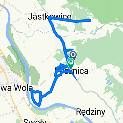
- noworocznie po okolicy
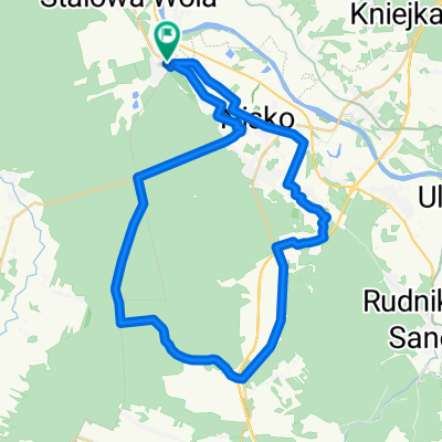
- Distance
- 40.2 km
- Ascent
- 89 m
- Descent
- 88 m
- Location
- Pysznica, Subcarpathian Voivodeship, Poland
- Cziki bomba
- Distance
- 59.8 km
- Ascent
- 98 m
- Descent
- 99 m
- Location
- Pysznica, Subcarpathian Voivodeship, Poland
- Imielity 艁ug od drugiej strony
- Distance
- 47 km
- Ascent
- 87 m
- Descent
- 87 m
- Location
- Pysznica, Subcarpathian Voivodeship, Poland
- Wykona膰 niemo偶liwe...
- Distance
- 50.2 km
- Ascent
- 99 m
- Descent
- 99 m
- Location
- Pysznica, Subcarpathian Voivodeship, Poland
- Pysznica - Radomy艣l - K臋pie Zalesza艅skie - Stalowa Wola - Pysznica
- Distance
- 53.4 km
- Ascent
- 26 m
- Descent
- 27 m
- Location
- Pysznica, Subcarpathian Voivodeship, Poland
- Lasy |Janowskie - odcinek 1214
- Distance
- 115.3 km
- Ascent
- 149 m
- Descent
- 148 m
- Location
- Pysznica, Subcarpathian Voivodeship, Poland
- Po dro偶ach i bezdro偶ach Las贸w Janowskich (+ Bomba)
- Distance
- 88.2 km
- Ascent
- 114 m
- Descent
- 115 m
- Location
- Pysznica, Subcarpathian Voivodeship, Poland
Open it in the app