

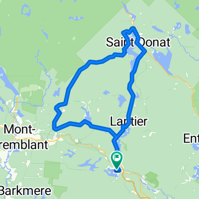
lanthier
A cycling route starting in Sainte-Agathe-des-Monts, Quebec, Canada.
Overview
About this route
- -:--
- Duration
- 65 km
- Distance
- 299 m
- Ascent
- 303 m
- Descent
- ---
- Avg. speed
- ---
- Max. altitude

Route quality
Waytypes & surfaces along the route
Waytypes
Road
36.4 km
(56 %)
Cycleway
20.8 km
(32 %)
Surfaces
Paved
46.1 km
(71 %)
Asphalt
45.5 km
(70 %)
Paved (undefined)
0.6 km
(1 %)
Undefined
18.8 km
(29 %)
Continue with Bikemap
Use, edit, or download this cycling route
You would like to ride lanthier or customize it for your own trip? Here is what you can do with this Bikemap route:
Free features
- Save this route as favorite or in collections
- Copy & plan your own version of this route
- Sync your route with Garmin or Wahoo
Premium features
Free trial for 3 days, or one-time payment. More about Bikemap Premium.
- Navigate this route on iOS & Android
- Export a GPX / KML file of this route
- Create your custom printout (try it for free)
- Download this route for offline navigation
Discover more Premium features.
Get Bikemap PremiumFrom our community
Other popular routes starting in Sainte-Agathe-des-Monts
 CC 2719 route 2
- Distance
- 140.3 km
- Ascent
- 409 m
- Descent
- 640 m
- Location
- Sainte-Agathe-des-Monts, Quebec, Canada
 Ste-Agathe/St-Donat/LacSuperieur/Lanthier/Ste-Agathe
- Distance
- 108 km
- Ascent
- 665 m
- Descent
- 662 m
- Location
- Sainte-Agathe-des-Monts, Quebec, Canada
 lanthier
- Distance
- 65 km
- Ascent
- 299 m
- Descent
- 303 m
- Location
- Sainte-Agathe-des-Monts, Quebec, Canada
 Défi VQ 2012-2 Laurentide 150km approx
- Distance
- 151.7 km
- Ascent
- 791 m
- Descent
- 791 m
- Location
- Sainte-Agathe-des-Monts, Quebec, Canada
 Weekend Cottage Ride
- Distance
- 60.4 km
- Ascent
- 592 m
- Descent
- 599 m
- Location
- Sainte-Agathe-des-Monts, Quebec, Canada
 Ch. des Bouleaux
- Distance
- 28.8 km
- Ascent
- 425 m
- Descent
- 424 m
- Location
- Sainte-Agathe-des-Monts, Quebec, Canada
 3 villages
- Distance
- 56.6 km
- Ascent
- 631 m
- Descent
- 631 m
- Location
- Sainte-Agathe-des-Monts, Quebec, Canada
 StLucie-StDonat
- Distance
- 100.7 km
- Ascent
- 517 m
- Descent
- 513 m
- Location
- Sainte-Agathe-des-Monts, Quebec, Canada
Open it in the app