

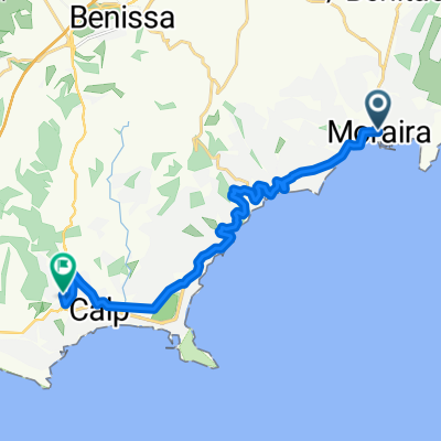
Montemar
A cycling route starting in Moraira, Valencia, Spain.
Overview
About this route
- 1 h 27 min
- Duration
- 21.2 km
- Distance
- 443 m
- Ascent
- 445 m
- Descent
- 14.6 km/h
- Avg. speed
- ---
- Max. altitude

Continue with Bikemap
Use, edit, or download this cycling route
You would like to ride Montemar or customize it for your own trip? Here is what you can do with this Bikemap route:
Free features
- Save this route as favorite or in collections
- Copy & plan your own version of this route
- Sync your route with Garmin or Wahoo
Premium features
Free trial for 3 days, or one-time payment. More about Bikemap Premium.
- Navigate this route on iOS & Android
- Export a GPX / KML file of this route
- Create your custom printout (try it for free)
- Download this route for offline navigation
Discover more Premium features.
Get Bikemap PremiumFrom our community
Other popular routes starting in Moraira
 Lengthy ride through Teulada
- Distance
- 75.1 km
- Ascent
- 935 m
- Descent
- 906 m
- Location
- Moraira, Valencia, Spain
 Moraira Runde
- Distance
- 25.7 km
- Ascent
- 392 m
- Descent
- 388 m
- Location
- Moraira, Valencia, Spain
 Carrer del Mar Egeo, Teulada to Carrer Hortolà, Benissa
- Distance
- 8 km
- Ascent
- 163 m
- Descent
- 198 m
- Location
- Moraira, Valencia, Spain
 Montemar
- Distance
- 21.2 km
- Ascent
- 443 m
- Descent
- 445 m
- Location
- Moraira, Valencia, Spain
 38.686, 0.102 to 38.697, 0.086
- Distance
- 4.4 km
- Ascent
- 206 m
- Descent
- 56 m
- Location
- Moraira, Valencia, Spain
 Moraira - Calpe (treinstation)
- Distance
- 16.3 km
- Ascent
- 334 m
- Descent
- 239 m
- Location
- Moraira, Valencia, Spain
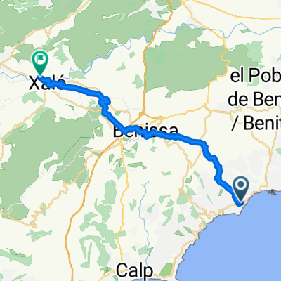 Calle del Cabo Azul, Teulada to Avenida del Rey Juan Carlos I, Xaló
- Distance
- 18.8 km
- Ascent
- 497 m
- Descent
- 341 m
- Location
- Moraira, Valencia, Spain
 el portet
- Distance
- 16.2 km
- Ascent
- 516 m
- Descent
- 516 m
- Location
- Moraira, Valencia, Spain
Open it in the app