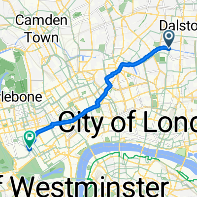
Monopoly
A cycling route starting in Islington, England, United Kingdom.
Overview
About this route
The Angel Islington
Pentonville Road
King’s Cross Station
Euston Road
Oxford Street
Marylebone Station
Park Lane
Bond Street
Mayfair
Marlborough Street
Regent Street
Vine Street
Piccadilly
Coventry Street
Leicester Square
Bow Street
Strand
Northumberland Avenue
Trafalgar Square
Pall Mall
Whitehall
Old Kent Road
Fleet Street
Fenchurch Street Station
Liverpool Street Station
Whitechapel Road
Â
- -:--
- Duration
- 32.7 km
- Distance
- 137 m
- Ascent
- 142 m
- Descent
- ---
- Avg. speed
- ---
- Avg. speed
Route quality
Waytypes & surfaces along the route
Waytypes
Quiet road
12.4 km
(38 %)
Busy road
8.1 km
(25 %)
Surfaces
Paved
31.1 km
(95 %)
Unpaved
0.2 km
(<1 %)
Asphalt
28.6 km
(87 %)
Paving stones
2.3 km
(7 %)
Continue with Bikemap
Use, edit, or download this cycling route
You would like to ride Monopoly or customize it for your own trip? Here is what you can do with this Bikemap route:
Free features
- Save this route as favorite or in collections
- Copy & plan your own version of this route
- Sync your route with Garmin or Wahoo
Premium features
Free trial for 3 days, or one-time payment. More about Bikemap Premium.
- Navigate this route on iOS & Android
- Export a GPX / KML file of this route
- Create your custom printout (try it for free)
- Download this route for offline navigation
Discover more Premium features.
Get Bikemap PremiumFrom our community
Other popular routes starting in Islington
- 43–53 Barnsbury Street, London to 56 Brooksby Street, London
- Distance
- 0.3 km
- Ascent
- 3 m
- Descent
- 0 m
- Location
- Islington, England, United Kingdom
- Rosemary Branch Haggerston return via Pitfield Street
- Distance
- 8.9 km
- Ascent
- 35 m
- Descent
- 47 m
- Location
- Islington, England, United Kingdom
- Sunday Hackney March
- Distance
- 26.2 km
- Ascent
- 48 m
- Descent
- 49 m
- Location
- Islington, England, United Kingdom
- Evening leg turner
- Distance
- 22.1 km
- Ascent
- 68 m
- Descent
- 68 m
- Location
- Islington, England, United Kingdom
- Sunday Morning
- Distance
- 23.9 km
- Ascent
- 99 m
- Descent
- 98 m
- Location
- Islington, England, United Kingdom
- London Hobgoblin Ride
- Distance
- 39.5 km
- Ascent
- 145 m
- Descent
- 145 m
- Location
- Islington, England, United Kingdom
- PIZZA RIDE
- Distance
- 18.4 km
- Ascent
- 41 m
- Descent
- 49 m
- Location
- Islington, England, United Kingdom
- Political Waters in Ilinghton and Hackney
- Distance
- 15.4 km
- Ascent
- 51 m
- Descent
- 49 m
- Location
- Islington, England, United Kingdom