

Saddleworth Moors Expedition
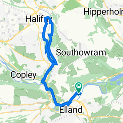
A cycling route starting in Elland, England, United Kingdom.
Overview
About this route
- -:--
- Duration
- 53.9 km
- Distance
- 800 m
- Ascent
- 799 m
- Descent
- ---
- Avg. speed
- ---
- Max. altitude

Route quality
Waytypes & surfaces along the route
Waytypes
Busy road
30.6 km
(57 %)
Quiet road
12.9 km
(24 %)
Surfaces
Paved
20.3 km
(38 %)
Unpaved
0.7 km
(1 %)
Asphalt
18.9 km
(35 %)
Paved (undefined)
1.5 km
(3 %)
Continue with Bikemap
Use, edit, or download this cycling route
You would like to ride Saddleworth Moors Expedition or customize it for your own trip? Here is what you can do with this Bikemap route:
Free features
- Save this route as favorite or in collections
- Copy & plan your own version of this route
- Sync your route with Garmin or Wahoo
Premium features
Free trial for 3 days, or one-time payment. More about Bikemap Premium.
- Navigate this route on iOS & Android
- Export a GPX / KML file of this route
- Create your custom printout (try it for free)
- Download this route for offline navigation
Discover more Premium features.
Get Bikemap PremiumFrom our community
Other popular routes starting in Elland
 Salending Nook to Holme Moss
- Distance
- 41.6 km
- Ascent
- 1,005 m
- Descent
- 1,005 m
- Location
- Elland, England, United Kingdom
 Salendine Nook to Holme Moss
- Distance
- 49.7 km
- Ascent
- 1,047 m
- Descent
- 1,047 m
- Location
- Elland, England, United Kingdom
 Premier Way to Premier Way
- Distance
- 13 km
- Ascent
- 139 m
- Descent
- 185 m
- Location
- Elland, England, United Kingdom
 Elland Bridge to Brighouse back to Elland Bridge
- Distance
- 10.8 km
- Ascent
- 98 m
- Descent
- 103 m
- Location
- Elland, England, United Kingdom
 Pain in the Pennines, 15 June 2008
- Distance
- 172.6 km
- Ascent
- 2,199 m
- Descent
- 2,200 m
- Location
- Elland, England, United Kingdom
 local 5 miles
- Distance
- 8.2 km
- Ascent
- 243 m
- Descent
- 253 m
- Location
- Elland, England, United Kingdom
 Saddleworth Road 342, Greetland to Saddleworth Road 344, Greetland
- Distance
- 4.3 km
- Ascent
- 52 m
- Descent
- 0 m
- Location
- Elland, England, United Kingdom
 From Sally up Cragg via Mytholmroyd
- Distance
- 41.4 km
- Ascent
- 825 m
- Descent
- 825 m
- Location
- Elland, England, United Kingdom
Open it in the app