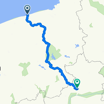
Große Kolberg-Rundfahrt
A cycling route starting in Kołobrzeg, West Pomeranian Voivodeship, Poland.
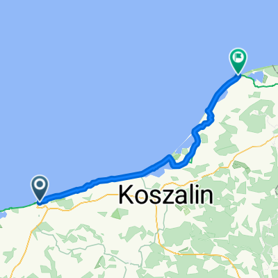
Overview
About this route
Strecke Kolberg (11)-Köslin (6)-Karlino (163)-Kolberg.
In Polen sind die Straßen alle eine Kategorie schwächer ausgeprägt als in Dtl. D.h.: Was auf der Karte wie eine Autobahn anmutet (11 & 6), ist wie eine einspurige Bundesstr. bei uns. Und die 163 ist wie eine Landstr.
Schöne einfache Route, bei der man ohne in die Karte zu schauen einfach durchradeln kann.
- -:--
- Duration
- 96.7 km
- Distance
- 172 m
- Ascent
- 172 m
- Descent
- ---
- Avg. speed
- ---
- Max. altitude
Route quality
Waytypes & surfaces along the route
Waytypes
Busy road
53.6 km
(55 %)
Cycleway
17 km
(18 %)
Surfaces
Paved
91.8 km
(95 %)
Unpaved
1.3 km
(1 %)
Asphalt
75.4 km
(78 %)
Paving stones
14.6 km
(15 %)
Continue with Bikemap
Use, edit, or download this cycling route
You would like to ride Große Kolberg-Rundfahrt or customize it for your own trip? Here is what you can do with this Bikemap route:
Free features
- Save this route as favorite or in collections
- Copy & plan your own version of this route
- Split it into stages to create a multi-day tour
- Sync your route with Garmin or Wahoo
Premium features
Free trial for 3 days, or one-time payment. More about Bikemap Premium.
- Navigate this route on iOS & Android
- Export a GPX / KML file of this route
- Create your custom printout (try it for free)
- Download this route for offline navigation
Discover more Premium features.
Get Bikemap PremiumFrom our community
Other popular routes starting in Kołobrzeg
- Jeziora Kamienica i Popiel
- Distance
- 61.6 km
- Ascent
- 183 m
- Descent
- 152 m
- Location
- Kołobrzeg, West Pomeranian Voivodeship, Poland
- Kołobrzeg Dźwirzyno
- Distance
- 39.1 km
- Ascent
- 59 m
- Descent
- 56 m
- Location
- Kołobrzeg, West Pomeranian Voivodeship, Poland
- Pomorze 2017
- Distance
- 285.9 km
- Ascent
- 206 m
- Descent
- 208 m
- Location
- Kołobrzeg, West Pomeranian Voivodeship, Poland
- Kołobrzeg-Mrzeżyno-Kołobrzeg
- Distance
- 44.2 km
- Ascent
- 3 m
- Descent
- 0 m
- Location
- Kołobrzeg, West Pomeranian Voivodeship, Poland
- Szlak solny
- Distance
- 31.2 km
- Ascent
- 103 m
- Descent
- 70 m
- Location
- Kołobrzeg, West Pomeranian Voivodeship, Poland
- Kołobrzeg - Dygowo - Ustronie Morskie - Kołobrzeg
- Distance
- 43.7 km
- Ascent
- 79 m
- Descent
- 79 m
- Location
- Kołobrzeg, West Pomeranian Voivodeship, Poland
- Malinowa 50, Zieleniewo do Wyzwolenia 40O, Dźwirzyno
- Distance
- 12.5 km
- Ascent
- 42 m
- Descent
- 52 m
- Location
- Kołobrzeg, West Pomeranian Voivodeship, Poland
- Szlak do najstarszych dębów 2025
- Distance
- 30.5 km
- Ascent
- 367 m
- Descent
- 368 m
- Location
- Kołobrzeg, West Pomeranian Voivodeship, Poland
Open it in the app