
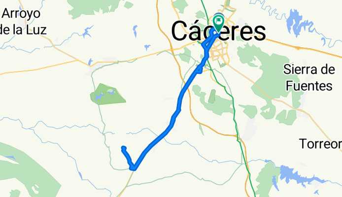
Cáceres - Ermita de San Jorge
A cycling route starting in Cáceres, Extremadura, Spain.
Overview
About this route
- 2 h 36 min
- Duration
- 38.3 km
- Distance
- 360 m
- Ascent
- 337 m
- Descent
- 14.7 km/h
- Avg. speed
- ---
- Max. altitude

Route photos


Route quality
Waytypes & surfaces along the route
Waytypes
Cycleway
18.4 km
(48 %)
Track
6.9 km
(18 %)
Surfaces
Paved
29.5 km
(77 %)
Unpaved
5.7 km
(15 %)
Asphalt
24.1 km
(63 %)
Ground
5.7 km
(15 %)
Continue with Bikemap
Use, edit, or download this cycling route
You would like to ride Cáceres - Ermita de San Jorge or customize it for your own trip? Here is what you can do with this Bikemap route:
Free features
- Save this route as favorite or in collections
- Copy & plan your own version of this route
- Sync your route with Garmin or Wahoo
Premium features
Free trial for 3 days, or one-time payment. More about Bikemap Premium.
- Navigate this route on iOS & Android
- Export a GPX / KML file of this route
- Create your custom printout (try it for free)
- Download this route for offline navigation
Discover more Premium features.
Get Bikemap PremiumFrom our community
Other popular routes starting in Cáceres
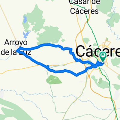 RUTA 7- CC-ARENALES-ARROYO
- Distance
- 44.9 km
- Ascent
- 169 m
- Descent
- 176 m
- Location
- Cáceres, Extremadura, Spain
 Ruta de las Avutardas
- Distance
- 52.1 km
- Ascent
- 476 m
- Descent
- 476 m
- Location
- Cáceres, Extremadura, Spain
 Perderse
- Distance
- 35.8 km
- Ascent
- 674 m
- Descent
- 703 m
- Location
- Cáceres, Extremadura, Spain
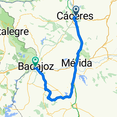 CACERES - BADAJOZ (LLA) ETAPA 2
- Distance
- 209.8 km
- Ascent
- 892 m
- Descent
- 1,093 m
- Location
- Cáceres, Extremadura, Spain
 CC-Casar-Malpartica-CC
- Distance
- 45.1 km
- Ascent
- 299 m
- Descent
- 298 m
- Location
- Cáceres, Extremadura, Spain
 Altagracia
- Distance
- 68.4 km
- Ascent
- 294 m
- Descent
- 294 m
- Location
- Cáceres, Extremadura, Spain
 CC - Casar - Guadilova - Sierra Fuentes - CC
- Distance
- 53.1 km
- Ascent
- 528 m
- Descent
- 535 m
- Location
- Cáceres, Extremadura, Spain
 CASAR- RIBEROS MONROY
- Distance
- 73.6 km
- Ascent
- 543 m
- Descent
- 538 m
- Location
- Cáceres, Extremadura, Spain
Open it in the app