

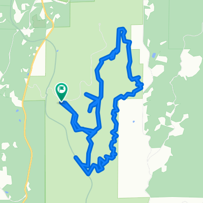
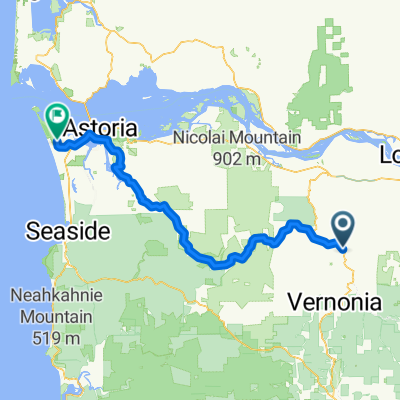
Vernonia Loop
A cycling route starting in Vernonia, Oregon, United States.
Overview
About this route
Need to ride to verify if all roads are paved.
- -:--
- Duration
- 81.4 km
- Distance
- 734 m
- Ascent
- 734 m
- Descent
- ---
- Avg. speed
- ---
- Max. altitude

Continue with Bikemap
Use, edit, or download this cycling route
You would like to ride Vernonia Loop or customize it for your own trip? Here is what you can do with this Bikemap route:
Free features
- Save this route as favorite or in collections
- Copy & plan your own version of this route
- Split it into stages to create a multi-day tour
- Sync your route with Garmin or Wahoo
Premium features
Free trial for 3 days, or one-time payment. More about Bikemap Premium.
- Navigate this route on iOS & Android
- Export a GPX / KML file of this route
- Create your custom printout (try it for free)
- Download this route for offline navigation
Discover more Premium features.
Get Bikemap PremiumFrom our community
Other popular routes starting in Vernonia
 Draft Route
- Distance
- 36 km
- Ascent
- 175 m
- Descent
- 301 m
- Location
- Vernonia, Oregon, United States
 Vernonia Loop
- Distance
- 81.4 km
- Ascent
- 734 m
- Descent
- 734 m
- Location
- Vernonia, Oregon, United States
 LL stub loop
- Distance
- 12.3 km
- Ascent
- 869 m
- Descent
- 867 m
- Location
- Vernonia, Oregon, United States
 Lengthy Afternoon Course In Buxton
- Distance
- 17.1 km
- Ascent
- 182 m
- Descent
- 462 m
- Location
- Vernonia, Oregon, United States
 Portland Day 2
- Distance
- 106.4 km
- Ascent
- 490 m
- Descent
- 676 m
- Location
- Vernonia, Oregon, United States
 Jefferson Avenue 450, Vernonia to Bridge Street 182-184, Vernonia
- Distance
- 28.8 km
- Ascent
- 231 m
- Descent
- 237 m
- Location
- Vernonia, Oregon, United States
 June 26
- Distance
- 35 km
- Ascent
- 472 m
- Descent
- 603 m
- Location
- Vernonia, Oregon, United States
 Big Eddy to Fort Stevens
- Distance
- 94.7 km
- Ascent
- 383 m
- Descent
- 550 m
- Location
- Vernonia, Oregon, United States
Open it in the app