

2010 07 00 Vysokohorská přes Masaryčku OH
A cycling route starting in Náchod, Královéhradecký kraj, Czechia.
Overview
About this route
The more information you write here, the more useful it will be for other users.<br /><br />* Route progress.<br />* What is special about this route?<br />* Why recommend this route?<br />* What did you like the most here?<br />* etc.
- -:--
- Duration
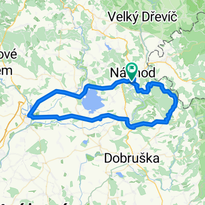
- 47 km
- Distance
- 816 m
- Ascent
- 851 m
- Descent
- ---
- Avg. speed
- ---
- Max. altitude

Route quality
Waytypes & surfaces along the route
Waytypes
Track
16.4 km
(35 %)
Road
2.3 km
(5 %)
Surfaces
Paved
31.9 km
(68 %)
Unpaved
8.9 km
(19 %)
Asphalt
30.5 km
(65 %)
Ground
5.2 km
(11 %)
Continue with Bikemap
Use, edit, or download this cycling route
You would like to ride 2010 07 00 Vysokohorská přes Masaryčku OH or customize it for your own trip? Here is what you can do with this Bikemap route:
Free features
- Save this route as favorite or in collections
- Copy & plan your own version of this route
- Sync your route with Garmin or Wahoo
Premium features
Free trial for 3 days, or one-time payment. More about Bikemap Premium.
- Navigate this route on iOS & Android
- Export a GPX / KML file of this route
- Create your custom printout (try it for free)
- Download this route for offline navigation
Discover more Premium features.
Get Bikemap PremiumFrom our community
Other popular routes starting in Náchod
 2010 07 00 Vysokohorská přes Masaryčku OH
- Distance
- 47 km
- Ascent
- 816 m
- Descent
- 851 m
- Location
- Náchod, Královéhradecký kraj, Czechia
 Náchod-Šerlich-Mladkov-Letohrad-Žďár
- Distance
- 145.4 km
- Ascent
- 1,112 m
- Descent
- 1,219 m
- Location
- Náchod, Královéhradecký kraj, Czechia
 jaromer turnov
- Distance
- 172.4 km
- Ascent
- 840 m
- Descent
- 899 m
- Location
- Náchod, Královéhradecký kraj, Czechia
 Kudowa Zdrój - Praga BOSCOTEAM
- Distance
- 151.6 km
- Ascent
- 298 m
- Descent
- 448 m
- Location
- Náchod, Královéhradecký kraj, Czechia
 Objezd ČR IX.
- Distance
- 202.8 km
- Ascent
- 2,247 m
- Descent
- 1,893 m
- Location
- Náchod, Královéhradecký kraj, Czechia
 Náchod-Jaroměř-Nové Město-Nový Hrádek
- Distance
- 64.7 km
- Ascent
- 594 m
- Descent
- 594 m
- Location
- Náchod, Královéhradecký kraj, Czechia
 bajková Borová
- Distance
- 26.3 km
- Ascent
- 684 m
- Descent
- 681 m
- Location
- Náchod, Královéhradecký kraj, Czechia
 Na 3 kopce - Sendraž, Dobrošov, Přibyslav
- Distance
- 34.3 km
- Ascent
- 752 m
- Descent
- 752 m
- Location
- Náchod, Královéhradecký kraj, Czechia
Open it in the app