

Königsstuhl - Wilhelmsfeld - Langenthal - Rothenberg - Rippenweier
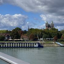
A cycling route starting in Altrip, Rhineland-Palatinate, Germany.
Overview
About this route
- -:--
- Duration
- 111.4 km
- Distance
- 1,574 m
- Ascent
- 1,576 m
- Descent
- ---
- Avg. speed
- ---
- Max. altitude

Route quality
Waytypes & surfaces along the route
Waytypes
Quiet road
26.7 km
(24 %)
Road
23.4 km
(21 %)
Surfaces
Paved
86.9 km
(78 %)
Unpaved
14.5 km
(13 %)
Asphalt
85.8 km
(77 %)
Gravel
11.1 km
(10 %)
Continue with Bikemap
Use, edit, or download this cycling route
You would like to ride Königsstuhl - Wilhelmsfeld - Langenthal - Rothenberg - Rippenweier or customize it for your own trip? Here is what you can do with this Bikemap route:
Free features
- Save this route as favorite or in collections
- Copy & plan your own version of this route
- Split it into stages to create a multi-day tour
- Sync your route with Garmin or Wahoo
Premium features
Free trial for 3 days, or one-time payment. More about Bikemap Premium.
- Navigate this route on iOS & Android
- Export a GPX / KML file of this route
- Create your custom printout (try it for free)
- Download this route for offline navigation
Discover more Premium features.
Get Bikemap PremiumFrom our community
Other popular routes starting in Altrip
 Ma - Heddesheim -Fürth -Unter-Ostern -Reichelsheim -Gumpen -Heddesheim
- Distance
- 106.7 km
- Ascent
- 307 m
- Descent
- 308 m
- Location
- Altrip, Rhineland-Palatinate, Germany
 Altrip - Kalmit - Rotsteig CLONED FROM ROUTE 136545
- Distance
- 103.2 km
- Ascent
- 1,292 m
- Descent
- 1,269 m
- Location
- Altrip, Rhineland-Palatinate, Germany
 zum Dom nach Speyer und zurück
- Distance
- 47.9 km
- Ascent
- 108 m
- Descent
- 109 m
- Location
- Altrip, Rhineland-Palatinate, Germany
 Mannheimrunde
- Distance
- 76.2 km
- Ascent
- 30 m
- Descent
- 28 m
- Location
- Altrip, Rhineland-Palatinate, Germany
 Velotour 2021 Tag 4
- Distance
- 82.9 km
- Ascent
- 39 m
- Descent
- 39 m
- Location
- Altrip, Rhineland-Palatinate, Germany
 Altrip - Hohe List
- Distance
- 135.4 km
- Ascent
- 1,318 m
- Descent
- 975 m
- Location
- Altrip, Rhineland-Palatinate, Germany
 Neckarau - Hirschacker - Edingen-Neckarhausen
- Distance
- 26.4 km
- Ascent
- 48 m
- Descent
- 49 m
- Location
- Altrip, Rhineland-Palatinate, Germany
 Nach Neustadt
- Distance
- 94.2 km
- Ascent
- 317 m
- Descent
- 313 m
- Location
- Altrip, Rhineland-Palatinate, Germany
Open it in the app