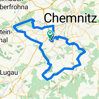
Klaffenbach - Eisenweg - Stollberg
A cycling route starting in Neukirchen, Saxony, Germany.
Overview
About this route
A scenery-wise very appealing tour, with many viewpoints along the way. Attractions include the water castle Klaffenbach, Jansdorf airport, heated outdoor pool in Brünlos, the old town in Stollberg, as well as a playground near Stollberg and Lugau. There are also plenty of restaurants or snack stands available for a break.
A tour to explore the foothills of the Erzgebirge. Have fun! =)
- -:--
- Duration
- 50.3 km
- Distance
- 458 m
- Ascent
- 462 m
- Descent
- ---
- Avg. speed
- ---
- Max. altitude
Route quality
Waytypes & surfaces along the route
Waytypes
Track
18.1 km
(36 %)
Quiet road
10.1 km
(20 %)
Surfaces
Paved
35.2 km
(70 %)
Unpaved
10.1 km
(20 %)
Asphalt
32.7 km
(65 %)
Unpaved (undefined)
3.5 km
(7 %)
Route highlights
Points of interest along the route
Point of interest after 8.3 km
Wasserschloss Klaffenbach
Point of interest after 14.1 km
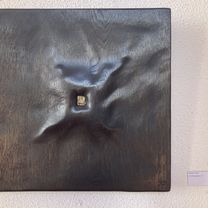
Ja Sie sind tatsächlich auf dem Fichtelberg mit dem Fahrrad. Auch wenns der kleine Bruder ist =)
Point of interest after 15.2 km
Aussichtspunkt - Hier sehen Sie ganz Chemnitz und Vororte
Point of interest after 21.5 km
Weihnachtsberg
Point of interest after 21.5 km
Point of interest after 22.3 km
Beheiztes Freibad
Point of interest after 24.4 km
Fichtelbergblick - Von hier sehen Sie den Fichtelberg
Point of interest after 29.2 km
Katzenstein - Höchster Punkt der Tour mit 622 müNN
Point of interest after 36.2 km
Alstadt von Stollberg und Jakobikirche
Point of interest after 40.9 km
Eisenbahnmuseum
Point of interest after 50.3 km
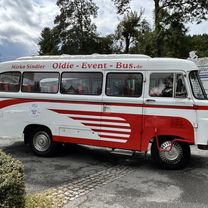
Gaststätte Sportlerheim
Continue with Bikemap
Use, edit, or download this cycling route
You would like to ride Klaffenbach - Eisenweg - Stollberg or customize it for your own trip? Here is what you can do with this Bikemap route:
Free features
- Save this route as favorite or in collections
- Copy & plan your own version of this route
- Sync your route with Garmin or Wahoo
Premium features
Free trial for 3 days, or one-time payment. More about Bikemap Premium.
- Navigate this route on iOS & Android
- Export a GPX / KML file of this route
- Create your custom printout (try it for free)
- Download this route for offline navigation
Discover more Premium features.
Get Bikemap PremiumFrom our community
Other popular routes starting in Neukirchen
 Chemnitz-Keilberg-Fichtelberg-Chemnitz
- Distance
- 119.9 km
- Ascent
- 1,362 m
- Descent
- 1,362 m
- Location
- Neukirchen, Saxony, Germany
 Erzgebirgstour
- Distance
- 96.5 km
- Ascent
- 1,517 m
- Descent
- 1,494 m
- Location
- Neukirchen, Saxony, Germany
 Eisenweg und Totenstein
- Distance
- 53.1 km
- Ascent
- 705 m
- Descent
- 704 m
- Location
- Neukirchen, Saxony, Germany
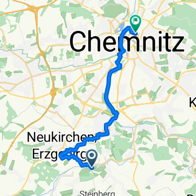
 Wasserschloßweg, Chemnitz nach An der Markthalle, Chemnitz
- Distance
- 19 km
- Ascent
- 244 m
- Descent
- 282 m
- Location
- Neukirchen, Saxony, Germany
 Hügelige Runde bei Chemnitz
- Distance
- 34.1 km
- Ascent
- 717 m
- Descent
- 714 m
- Location
- Neukirchen, Saxony, Germany
 Neukirchen - Lugau - Neukirchen
- Distance
- 28.1 km
- Ascent
- 197 m
- Descent
- 193 m
- Location
- Neukirchen, Saxony, Germany
 Adelsbergturm
- Distance
- 31.2 km
- Ascent
- 418 m
- Descent
- 430 m
- Location
- Neukirchen, Saxony, Germany
 Chemnitz Tour 2025
- Distance
- 15.4 km
- Ascent
- 120 m
- Descent
- 154 m
- Location
- Neukirchen, Saxony, Germany
Open it in the app

