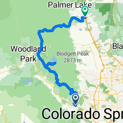
Manitou - gog- sinton - greenbelt - PP - M
- 27.9 km
- 287 m
- 288 m
- Manitou Springs, Colorado, United States
A cycling route starting in Manitou Springs, Colorado, United States.
Overview
created this 5 years ago
Route quality
Quiet road
3.7 km
(43 %)
Cycleway
3.6 km
(41 %)
Paved
5.1 km
(59 %)
Asphalt
2.3 km
(26 %)
Concrete
2.1 km
(24 %)
Continue with Bikemap
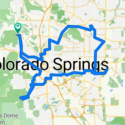
You would like to ride Restful route in Colorado Springs or customize it for your own trip? Here is what you can do with this Bikemap route:
Free trial for 3 days, or one-time payment. More about Bikemap Premium.
Discover more Premium features.
Get Bikemap PremiumFrom our community
Open it in the app